Perryville in Boyle County, Kentucky — The American South (East South Central)
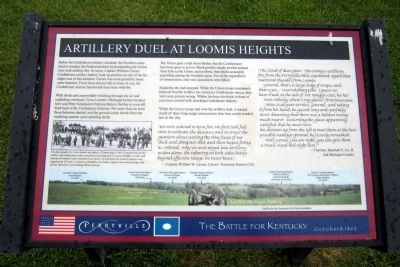
Artillery Duel at Loomis Heights
Perryville • The Battle For Kentucky
— October 8, 1862 —
With shells and cannonballs whistling through the air and exploding overhead, Cyrus Loomis’ Michigan battery located here and Peter Simonson’s Indiana Battery, further to your left, fired back at the Confederate battery. For more than an hour these batteries dueled, and the ground surely shook from the rumbling cannon and exploding shells.
The Union guns could shoot farther, but the Confederates had more guns in action. Black powder smoke swirled around these hills as the Union cannon fired, their shells accurately exploding among the Southern guns. For all the expenditure of ammunition, only two cannoneers were killed.
Suddenly, the duel stopped. While the Union troops mistakenly believed that the artillery fire covered a Confederate retreat, they were soon proven wrong. Within the hour the fields in front of you were covered with attacking Confederate infantry.
While the Union troops had won the artillery duel, it wasted much of their long-range ammunition that they sorely needed late in the day.
“We were ordered to open fire. We first took full time to estimate the distance and instruct the gunners about cutting the time fusses of our shell and shrapnel shot, and began firing as ordered. Why we were urged into artillery action alone, the infantry on both sides being beyond effective range, we never knew.”
—Captain William C. Carnes, Carnes’ Tennessee Battery CSA
“The cloud of dust grew. The enemy’s artillery fire from the Perryville hills slackened. Again that muttered thunder from Loomis: ‘General, that’s a large body of troops, and that’s yes, —Harrodsburg pike. I guess we have tread on the tail of Mr. Bragg’s coat, ha ha!’ Here orderly, where’s my glass?’ from Rousseau. ‘Mine is at your service, General,’ and taking it from his hand, he gazed long and carefully, never dreaming that there was a hidden enemy much nearer. Returning the glass apparently satisfied that he must move his division up from the left to meet them at the best possible vantage ground, he jocosely remarked: ‘Well Loomis, you are right, you can give them a small sized hell right here.’”
—Thatcher, Marshall P., Co.B, 2nd Michigan Cavalry
Erected by Cincinnati Civil War Roundtable.
Topics. This historical marker is listed in this topic list: War, US Civil.
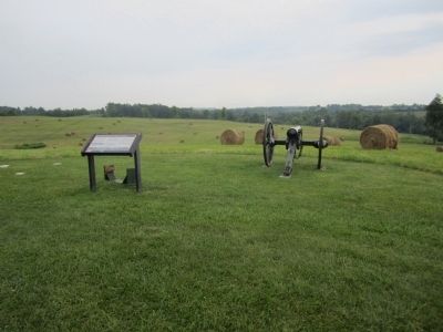
Location. 37° 40.033′ N, 84° 58.283′ W. Marker is in Perryville, Kentucky, in Boyle County. Marker can be reached from Park Road west of Battlefield Road (Kentucky Route 1920). Located in Perryville Battlefield State Historic Site. Touch for map. Marker is at or near this postal address: 1825 Battlefield Road, Perryville KY 40468, United States of America. Touch for directions.
Other nearby markers. At least 8 other markers are within walking distance of this marker. The 15th Kentucky Infantry (US) (about 300 feet away, measured in a direct line); Assault from the Bottom House (about 400 feet away); Assault From The Bottom House (about 400 feet away); Michigan at Perryville (about 400 feet away); Simonson’s Battery (about 400 feet away); Defense of Loomis’ Heights (about 500 feet away); Baptism of Fire (about 600 feet away); The H. P. Bottom House (about 700 feet away). Touch for a list and map of all markers in Perryville.
More about this marker. On the lower left is a photograph with the caption, “This photograph of a Union battery was taken in Chattanooga in 1863. Displayed here are the artillery and artillerymen as they would have been deployed on Loomis Heights. Loomis’ and Simonson’s batteries each consisted of six cannon. In total these two artillery batteries were supported by 201 men, 12 caissons, 28 limbers, two battery wagons, two traveling forges, and at least 168 horses, not including officer’s mounts."
Credits. This page was last revised on April 29, 2021. It was originally submitted on August 25, 2011, by Bernard Fisher of Richmond, Virginia. This page has been viewed 1,004 times since then and 23 times this year. Photos: 1, 2. submitted on August 25, 2011, by Bernard Fisher of Richmond, Virginia.

