St. Johns Bluff in Jacksonville in Duval County, Florida — The American South (South Atlantic)
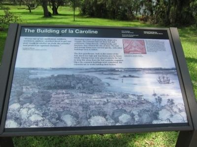
The Building of la Caroline
Fort Caroline National Monument
| — | Timucuan Ecological and Historic Preserve | — |
Photographed by Craig Swain, July 31, 2011
1. The Building of la Caroline Marker
Jacques le Moyne, 1564 la Caroline colonist and artist
Measuring a piece of ground in the shape of a triangle, the colonists laid out their fort and settlement. Using shovels, cutting hooks, and hatchets, they cleared the site of trees. The fort and storage barns were erected quickly, with other buildings soon to follow.
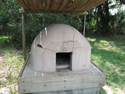
The first guardhouse, built in the center of the fort, stood too high and was blown over by fierce winds. Baking ovens were placed outside the fort to keep fire away from the fort's powder magazine. Once the common buildings were completed, the colonists set to work building their homes.
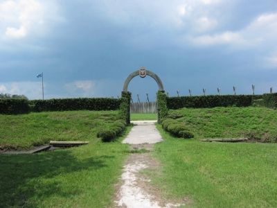
The original site and exact placement of the colony and fort are still a mystery to historians. In 1964, 400 years after the establishment of la Caroline, the fort you see before you was built by the National Park Service. It is not a reconstruction of the original, it is based on educated guesswork and serves only to bring the fort story alive.
Erected by National
this page online
Topics. This historical marker is listed in these topic lists: Colonial Era • Forts and Castles. A significant historical year for this entry is 1564.
Location. 30° 23.189′ N, 81° 29.99′ W. Marker is in Jacksonville, Florida, in Duval County. It is in St. Johns Bluff. It can be reached from Ft. Caroline Road, on the left when traveling east. Located on the tour trail from the visitor center in Fort Caroline National Monument. Touch for map. Marker is in this post office area: Jacksonville FL 32225, United States of America. Touch for directions.

Regionally, this marker is in First Coast. It is also in the American South and on the Eastern Seaboard. Globally, it is in the North Atlantic Region, North America, a Gulf of Mexico state, the Western Hemisphere, the Western World, and the Anglosphere. Historically, it finds itself in what was once New Spain, the territory of the Mississippian Culture, one of the Confederate States of America, and the Antebellum South.
Other nearby markers. At least 8 other markers are within walking distance of this marker: Building a Village in the Wilderness
Photographed by Craig Swain, July 31, 2011
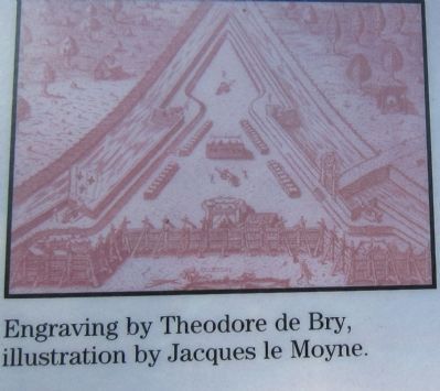
2. Engraving Showing the Layout of the Fort
Also see . . . Fort Caroline History. (Submitted on August 27, 2011, by Craig Swain of Leesburg, Virginia.)
Photographed by Craig Swain, July 31, 2011
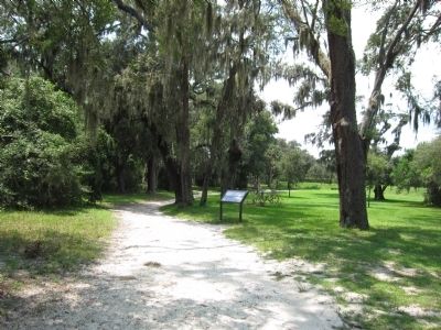
3. The Building of la Caroline Marker
Photographed by Craig Swain, July 31, 2011
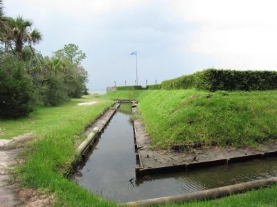
4. Fort Caroline
The reconstruction includes a moat and bastions similar to those seen on the engraving.
Photographed by Craig Swain, July 31, 2011
5. Entrance to Fort Caroline
Photographed by Craig Swain, July 31, 2011
6. Reconstructed Baking Oven
Credits. This page was last revised on February 3, 2023. It was originally submitted on August 27, 2011, by Craig Swain of Leesburg, Virginia. This page has been viewed 958 times since then and 29 times this year. Photos: 1, 2, 3, 4, 5, 6. submitted on August 27, 2011, by Craig Swain of Leesburg, Virginia.
