St. Johns Bluff in Jacksonville in Duval County, Florida — The American South (South Atlantic)
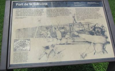
Fort de la Caroline
Fort Caroline National Monument
| — | Timucuan Ecological and Historic Preserve | — |
Photographed by Craig Swain, July 31, 2011
1. Fort de la Caroline Marker
1565 la Caroline carpenter Nicolas le Chaileux
Jean Ribault arrived at la Caroline on August 28, 1565, with reinforcements for the failing colony. On Ribault's heels stood a Spanish flotilla bent on ejecting the French. Escaping near-capture, Ribault sailed south to destroy the Spanish. A violent storm wrecked his fleet.
Assuming that la Caroline was now vulnerable, Spanish commander Pedro Menéndez ordered an overland assault; a French traitor led 500 Spaniards through jungle and swamp to capture the poorly guarded French colony. The Spaniards killed 143 French colonists, but spared 70 women and children. Laudonnière, le Moyne, and 40-50 others escaped into the woods and eventually back to France. Only one Spaniard died.
Seeking revenge, a French force led by Dominique de Gourgues returned to Fort de la Caroline (now called San Mateo) in April 1568. With Timucuan help the French surprised the Spaniards and captured the
this page online
Erected by National Park Service - U.S. Department of the Interior.
Topics. This historical marker is listed in these topic lists: Colonial Era • Forts and Castles. A significant historical month for this entry is April 1568.
Location. 30° 23.212′ N, 81° 30.024′ W. Marker is in Jacksonville, Florida, in Duval County. It is in St. Johns Bluff. It can be reached from Ft. Caroline Road, on the left when traveling east. Located on the tour trail from the visitor center in Fort Caroline National Monument. Touch for map. Marker is in this post office area: Jacksonville FL 32225, United States of America. Touch for directions.

Regionally, this marker is in First Coast. It is also in the American South and on the Eastern Seaboard. Globally, it is in the North Atlantic Region, North America, a Gulf of Mexico state, the Western Hemisphere, the Western World, and the Anglosphere. Historically, it finds itself in what was once New Spain, the territory of the Mississippian Culture, one of the Confederate States of America, and the Antebellum South.
Other nearby markers. At
Photographed by Craig Swain, July 31, 2011
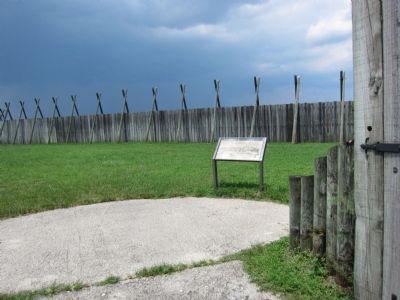
2. Fort de la Caroline Marker
Photographed by Craig Swain, July 31, 2011
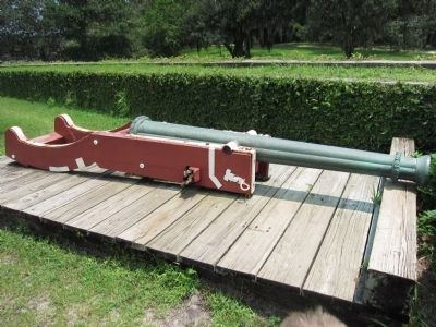
3. Reproduction Cannon at Fort Caroline
Photographed by Craig Swain, July 31, 2011
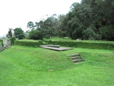
4. Firing Platform and Flank Defenses
Diagrams of the fort indicate the French built three bastions and provided elevated platforms to provide flank defenses for the fort's walls. Similar works are incorporated into the reconstructed fort.
Photographed by Craig Swain, July 31, 2011
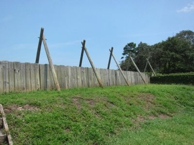
5. River Side Wall
Diagrams show the river side of the fort used a high wooden wall built of planks.
Credits. This page was last revised on February 3, 2023. It was originally submitted on August 27, 2011, by Craig Swain of Leesburg, Virginia. This page has been viewed 1,361 times since then and 43 times this year. Photos: 1, 2, 3, 4, 5. submitted on August 27, 2011, by Craig Swain of Leesburg, Virginia.
