Liberty in Clay County, Missouri — The American Midwest (Upper Plains)
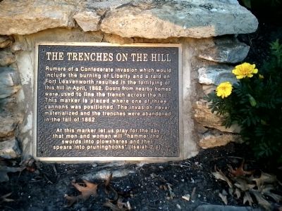
The Trenches On The Hill
At this marker let us pray for the day that men and women will “hammer their swords into plowshares and their spears into pruninghooks” (Isaiah 2:4).
Topics. This historical marker is listed in this topic list: War, US Civil. A significant historical month for this entry is April 1862.
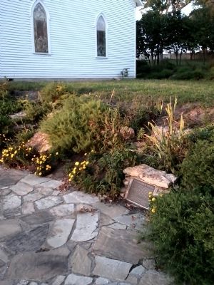
Location. 39° 14.905′ N, 94° 24.78′ W. Marker is in Liberty, Missouri, in Clay County. Marker can be reached from East MIssissippi Street, 0.1 miles east of North Jewell Street. This marker is located on a rock patio 20’ south of the Grand River Chapel on the campus of William Jewell College. Touch for map. Marker is at or near this postal address: 544 East Mississippi Street, Liberty MO 64068, United States of America. Touch for directions.
Other nearby markers. At least 8 other markers are within walking distance of this marker. Grand River Baptist Church (a few steps from this marker); Civil War Memorial (within shouting distance of this marker); Mass Grave Site (within shouting distance of this marker); John Priest Greene President's Home (within shouting distance of this marker); "The Old Graveyard" "Mt. Memorial Cemetery" (about 400 feet away, measured in a direct line); Goldman-Duckworth House (approx. ¼ mile away); Frank Hughes Memorial Library (approx. ¼ mile away); Methodist Episcopal Church Founded 1822 (approx. 0.3 miles away). Touch for a list and map of all markers in Liberty.
Additional keywords. William Jewell Liberty Missouri
Credits. This page was last revised on June 16, 2016. It was originally submitted on August 29, 2011, by Tony Meyers of Liberty, Missouri. This page has been viewed 1,023 times since then and 26 times this year. Photos: 1, 2. submitted on August 29, 2011, by Tony Meyers of Liberty, Missouri. • Craig Swain was the editor who published this page.

