Taylorsville in Bartow County, Georgia — The American South (South Atlantic)
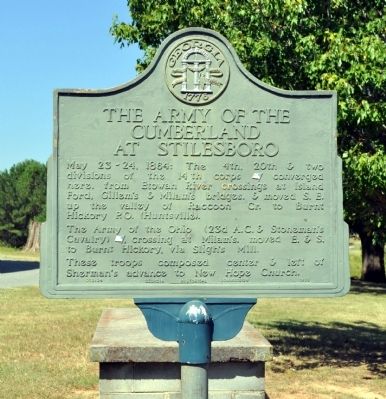
The Army of the Cumberland at Stilesboro
Photographed by David Seibert, August 28, 2011
1. The Army of the Cumberland at Stilesboro Marker
The Army of the Ohio (23d A.C. & Stoneman’s Cavalry) [US], crossing at Milam’s, moved E. & S. to Burnt Hickory, via Sligh’s Mill.
These troops composed center & left of Sherman’s advance to New Hope Church.
Erected 1953 by Georgia Historical Commission. (Marker Number 008-24.)
Topics and series. This historical marker is listed in this topic list: War, US Civil. In addition, it is included in the Georgia Historical Society series list. A significant historical date for this entry is May 23, 1884.
Location. 34° 6.207′ N, 84° 55.017′ W. Marker is in Taylorsville, Georgia, in Bartow County. It is on Taff Road 0.1 miles south of Rockmart Highway (Georgia Route 113), on the right when traveling south. The marker is off a spur of Taff Road, in the yard of the Stilesboro Academy, built in 1859. Touch for map. Marker is in this post office area: Taylorsville GA 30178, United States of America.
this page online

Regionally, this marker is in Georgia’s Mountains. It is also in the American South and specifically in the Deep South. Globally, it is in North America, the Western Hemisphere, the Western World, and the Anglosphere. Historically, it finds itself in what was once the original Cherokee Nation, the territory of the Mississippian Culture, one of the original Thirteen Colonies, one of the Confederate States of America, and the Antebellum South.
Other nearby markers. At least 8 other markers are within 6 miles of this marker, measured as the crow flies: Stilesboro Academy (within shouting distance of this marker); Raccoon Creek (approx. 1.9 miles away); Euharlee Creek Covered Bridge (approx. 2.9 miles away); Milam's Bridge (approx. 3.1 miles away); Black Pioneers Cemetery (approx. 3.2 miles away); Taylorsville High School (approx. 4.3 miles away); Etowah Valley Plantation (approx. 4.4 miles away); The Story of Old Hardin Bridge (approx. 5.9 miles away). Touch for a list and map of all markers in Taylorsville.
Another marker is no longer nearby. Sligh's Mill, Pottery & Tanyard (was approx.
Photographed by David Seibert, August 28, 2011
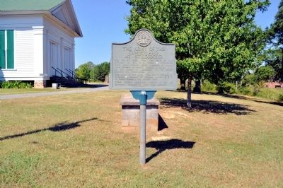
2. The Army of the Cumberland at Stilesboro Marker
More about this marker. The marker originally stood at the northeast corner of Ga Highway 113 (Rockmart Highway) and Old Stilesboro Road. It was moved to its present location prior to the widening of that intersection.
Photographed by David Seibert, August 28, 2011
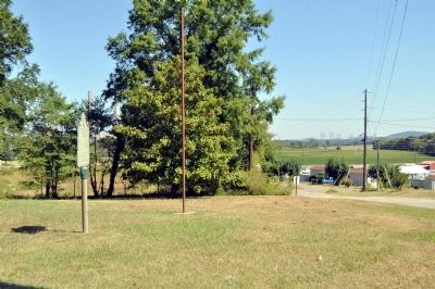
3. The Army of the Cumberland at Stilesboro Marker
Looking north on Taff Road (right) toward Georgia Highway 113 and the old town of Stilesboro beyond. The towers of Georgia Power's Plant Bowen, the largest coal-fired electricity generating plant in the U.S., can be seen through the trees.
Photographed by David Seibert, August 28, 2011
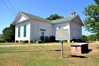
4. The Army of the Cumberland at Stilesboro Marker
The Stilesboro Academy (c. 1859) is in the background.

Photographed by David Seibert, August 28, 2011
5. The Stilesboro Academy
The Stilesboro Academy was built in 1859. Supposedly General Sherman refused to burn the building in 1864 because the inscription "Deo ac Patrae" (For God and Country) was painted on the wall of the auditorium.
Credits. This page was last revised on June 16, 2016. It was originally submitted on August 29, 2011, by David Seibert of Sandy Springs, Georgia. This page has been viewed 1,569 times since then and 54 times this year. Photos: 1, 2, 3, 4, 5. submitted on August 29, 2011, by David Seibert of Sandy Springs, Georgia. • Craig Swain was the editor who published this page.
