Anacostia in Southeast Washington in Washington, District of Columbia — The American Northeast (Mid-Atlantic)
Fort Stanton
Civil War Defenses of Washington
| — | 1861 – 1865 | — |
Photographed by Richard E. Miller, August 28, 2011
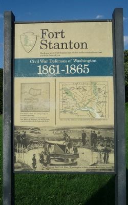
1. Fort Stanton Marker
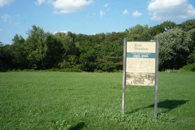
Earthworks of Fort Stanton are visible in the wooded area 200 yards in front of you.
Diagram:
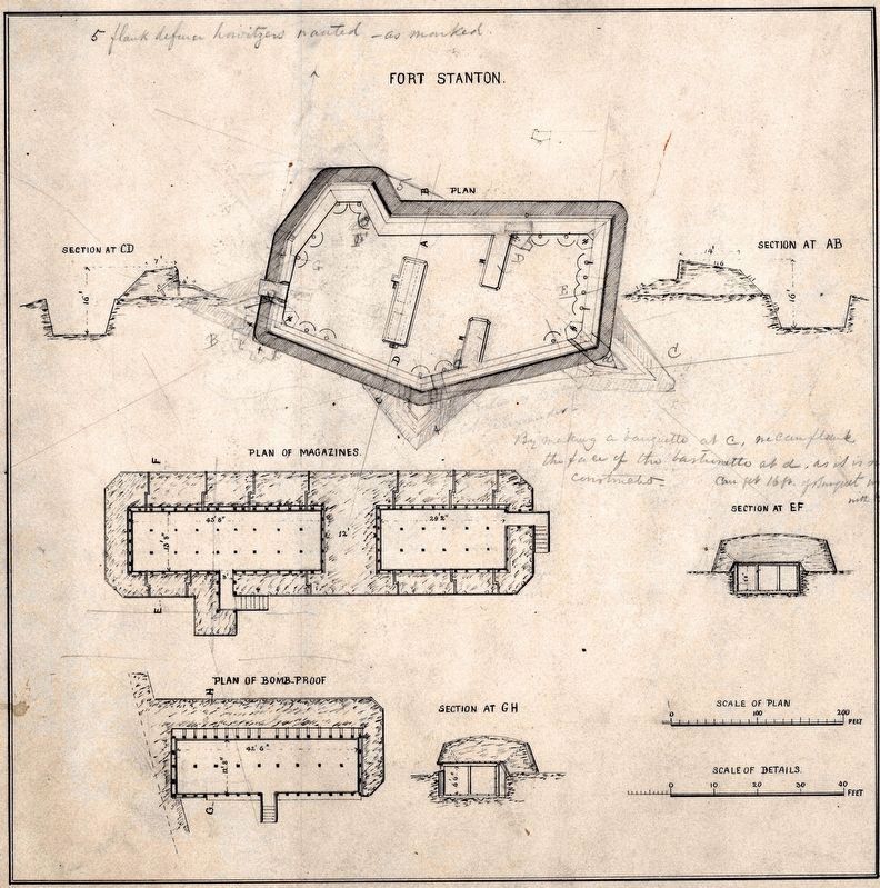
Fort Stanton from U.S. Army Corps of Engineers drawing.
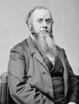
Fort Stanton was named for Secretary of War Edwin M. Stanton, was the first fort constructed beyond the Anacostia River.
Map:
Other Civil War fort locations administered by the National Park Service.
Period photograph of artillerists at an unspecified battery belonging to the Civil War Defenses of Washington: During the Civil War, Washington’s forts overlooked farm land.
Erected by National Park Service, U.S. Department of the Interior.
Topics and series. This historical marker is listed in these topic lists: Forts and Castles • War, US Civil. In addition, it is included in the Defenses of Washington series list.
Location. 38° 51.491′ N, 76° 58.977′ W. Marker is in Southeast Washington in Washington, District of Columbia. It is in Anacostia. It can be reached from Morris Road Southeast west of 16th Street Southeast, on the right when traveling west. Marker is south of the Fort Stanton works in a cleared field shown on road maps as the Wilkinson Recreation Center - off the northwest corner of the west parking lot for Our Lady of Perpetual Help Catholic Church. It is accessible via the church's driveway which is identified as "private property". Touch for map. Marker is at or near this postal address: 1600 Morris Road Southeast, Washington DC 20020, United States of America. Touch for directions.

Regionally, this marker is in the Washington Metropolitan Area. It is also in the American Northeast, in the Upper South, in the Mid-Atlantic, in the Tidewater, and in the Chesapeake Bay Region. Globally, it is in North America, the Western Hemisphere, the Western World, and the Anglosphere.
this page online
Other nearby markers. At least 8 other markers are within walking distance of this marker: Welcome to the Demonstration Garden (approx. 0.3 miles away); A Museum Without Walls (approx. 0.3 miles away); The Anacostia River: Pride and Preservation (approx. 0.3 miles away); The Anacostia River: People and Places (approx. 0.3 miles away); The Litter Bell (approx. 0.3 miles away); Frederick Douglass's Rustic Retreat (approx. 0.3 miles away); a different marker also named A Museum Without Walls (approx. 0.4 miles away); Frederick Douglass National Historic Site (approx. 0.4 miles away). Touch for a list and map of all markers in Southeast Washington.
Other markers no longer nearby. Thurgood Marshall (was approx. 0.3 miles away but has been permanently removed); The Growlery (was approx. 0.3 miles away but has been replaced with another marker now near it).
Also see . . .
1. Fort Stanton, Washington, DC. ... Not all the land that made up the site of Fort Stanton was converted to public park land. In 1920, local African-American Catholics constructed Our Lady of Perpetual Help church on land formerly owned by Dr. J.C.
Photographed by Richard E. Miller, August 28, 2011
2. Fort Stanton Marker
- with the remains of the fort's earthworks hidden by the trees beyond the grassy field.
2. Contraband: Former Slaves in the Capital during and after the Civil War. (Submitted on August 29, 2011, by Richard E. Miller of Oxon Hill, Maryland.)
Additional keywords. Our Lady of Perpetual Help Church; Fort Stanton, Anacostia.
Photographed by Richard E. Miller, August 28, 2011
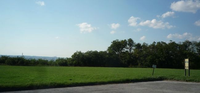
3. Fort Stanton Marker, at right, viewed from the church parking lot
with downtown Washington, DC (note the Washington Monument at left) in the background across the Anacostia River.
1860s
4. Edwin McMasters Stanton
Photographed by Devry Becker Jones (CC0), February 2, 2018
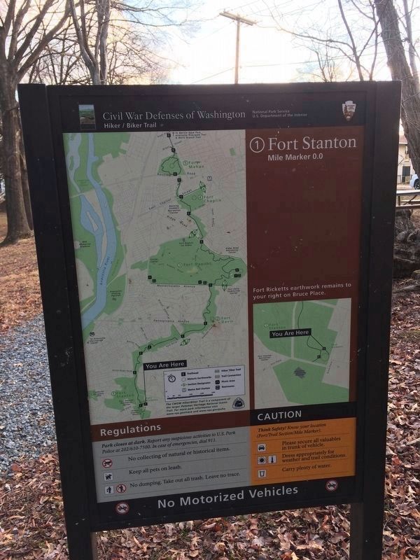
5. Sign at Fort Ricketts Park
Civil War Defenses of Washington
Hiker/Biker Trail
National Park Service
U.S. Department of the Interior
1. Fort Stanton
Mile Marker 0.0
Fort Ricketts earthwork remains to your right on Bruce Place.
Regulations
Park closes at dark. Report any suspicious activities to U.S. Park Police at 202/610-7500. In case of emergencies, dial 911.
No collecting of natural or historical items.
Keep all pets on leash.
No dumping. Take out all trash. Leave no trace.
Caution
Think Safety! Know your location (Fort/Trail Section/Mile Marker).
Please secure all valuables in trunk of vehicle.
Dress appropriately for weather and trail conditions.
Carry plenty of water.
National Archives
6. Fort Stanton
Plan and Sections of Fort Stanton, NAID: 122207037

National Archives
7. Fort Stanton Expanded Engineer Drawing
Fort Stanton was modified to include bastioned corners.

courtesy of U.S. Geological Survey, U.S. Department of the Interior, January 16, 2026
8. Fort Stanton 3DEP LiDAR Imagery
The two surviving bastions are apparent in this view from the USGS 3D Elevation Program.

Photographed by Evan Dwyer, January 17, 2026
9. Fort Stanton Remains
There is no path to the fort, and the church whose parking lot includes this marker has put up confusing signage about visitors. Regardless, while the marker is on church property, the fort itself is not - it's National Park property. This view is from the north and shows the two bastions at right & left, as well as the parapet linking them together. The exterior ditch has been partially filled in by years of erosion but the fort's walls are still impressive and distinctive in the fall & winter months.
Credits. This page was last revised on March 18, 2026. It was originally submitted on August 29, 2011, by Richard E. Miller of Oxon Hill, Maryland. This page has been viewed 1,808 times since then and 105 times this year. Photos: 1, 2, 3, 4. submitted on August 29, 2011, by Richard E. Miller of Oxon Hill, Maryland. 5. submitted on February 2, 2018, by Devry Becker Jones of Washington, District of Columbia. 6. submitted on March 12, 2024, by Allen C. Browne of Silver Spring, Maryland. 7, 8, 9. submitted on March 12, 2026, by Evan Dwyer of Richmond, Virginia. • Craig Swain was the editor who published this page.
