Near Daviston in Tallapoosa County, Alabama — The American South (East South Central)
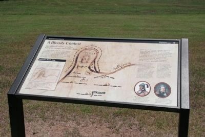
A Bloody Contest
Horseshoe Bend National Military Park
— National Park Service, U.S. Department of the Interior —
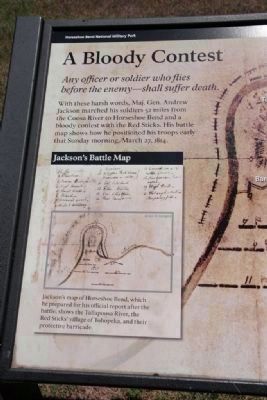
Any officer or soldiers who flies before the enemy-shall suffer death.
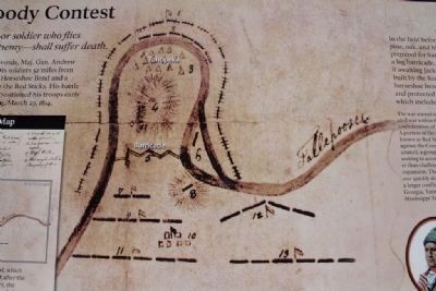
With these harsh words, Maj. Gen. Andrew Jackson marched his soldiers 52 miles from the Coosa River to Horseshoe Bend and a bloody contest with the Red Sticks. His battle map shows how he positioned his troops early that Sunday morning, March 27, 1814.
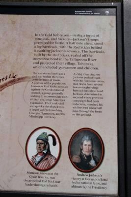
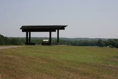
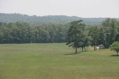
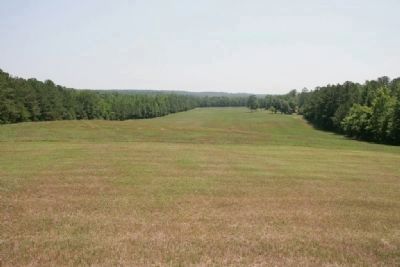
In the field before you-in 1814 a forest of pine, oak, and hickory-Jackson's troops prepared for battle. A half mile ahead stood a log barricade, with the Red Sticks behind it awaiting Jackson's advance. The barricade, built by the Red Sticks, sealed off the horseshoe bend in the Tallapoosa River and protected their village, Tohopeka, which included 350 women and children.
The war started in 1813 as a civil war within the Creek confederation of towns. A portion of the population, known as Red Sticks, rebelled against the Creek national council, a group generally seeking to accommodate rather than challenge American expansion. The Creek civil war quickly developed into a large conflict involving Georgia, Tennessee, and the Mississippi Territory.
As Maj. Gen. Andrew Jackson pushed south with his Tennessee army, Red Sticks from several towns sought refuge here at Horseshoe Bend. Jackson, determined to succeed where previous campaigns had been indecisive, marched his soldiers two and half days through the forest to this ground.
Erected by National Park Service, U.S. Department of the Interior.
Topics and series. This historical marker is listed in these topic lists: Native Americans • Wars, US Indian. In addition, it is included in the Former U.S. Presidents: #07 Andrew Jackson series list. A significant historical date for this entry is March 27, 1814.
Location. 32° 58.8′ N, 85° 44.024′ W. Marker is near Daviston, Alabama, in Tallapoosa County. Marker can be reached from Battlefield Park Tour Road, on the left. Marker is located about 150 yards above the Overlook Parking area on the grounds of Horseshoe Bend National Military Park along the Battlefield Park Road. Touch for map. Marker is at or near this postal address: 11288 Horseshoe Bend Road, Daviston AL 36256, United States of America. Touch for directions.
Other nearby markers. At least 8 other markers are within walking distance of this marker. Horseshoe Bend National Military Park (about 500 feet away, measured in a direct line); Horseshoe Bend Campaign Combatants (approx. 0.2 miles away); Gun Hill (approx. 0.3 miles away); Horseshoe Bend Battleground Monument (approx. 0.3 miles away); Futile Escape (approx. 0.3 miles away); Major Lemuel P. Montgomery (approx. 0.3 miles away); Jackson Trace (approx. 0.3 miles away); While the Long Roll Was Beating (approx. 0.4 miles away). Touch for a list and map of all markers in Daviston.
Also see . . .
1. Horseshoe Bend National Military Park. (Submitted on August 19, 2011, by Timothy Carr of Birmingham, Alabama.)
2. Battle of Horseshoe Bend. Encyclopedia of Alabama entry. (Submitted on August 19, 2011, by Timothy Carr of Birmingham, Alabama.)
Photographed By TRCP Alliance, June 16, 2011
4. (Center) Jackson's Battle Map
Jackson's map of Horseshoe Bend, which he prepared for his official report after the battle, shows the Tallapoosa River, the Red Sticks' village of Tohopeka, and their protective barricade.
1: Coffee's Cavalry
2: Cherokees
3: Indian Village
4: High Grounds
5: Breast Works
6: Loland
7: Advanced guard
8: Hill and Artillery
9: Regulars
10: Waggpon Pack Borres and wounded in center
11: Col. Copeland
12: E. Ten. Militia
13: Col. Cheatham
14: Rear Guard
1: Coffee's Cavalry
2: Cherokees
3: Indian Village
4: High Grounds
5: Breast Works
6: Loland
7: Advanced guard
8: Hill and Artillery
9: Regulars
10: Waggpon Pack Borres and wounded in center
11: Col. Copeland
12: E. Ten. Militia
13: Col. Cheatham
14: Rear Guard
Photographed By TRCP Alliance, June 16, 2011
6. Horseshoe Bend Battlefield
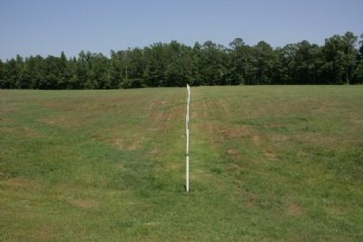
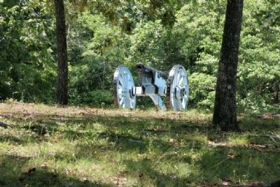
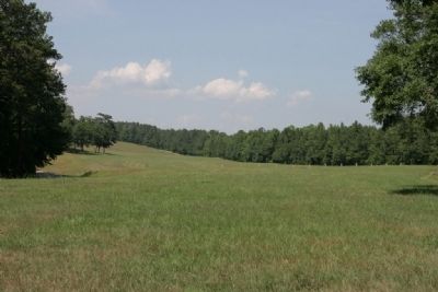
Andrew Jackson’s army arrived here about 10 a.m. on March 27, 1814. Brig. Gen. John Coffee’s mounted infantry and Indian allies crossed the Tallapoosa about three miles downstream and encircled the “horseshoe” so the Red Sticks could not get help from other towns or escape by swimming the river. Jackson deployed his own militia and regulars across the field and placed his artillery on the hill to your right. Straight ahead, behind their log barricade (marked by the line of white stakes), 1,000 Red Stick warriors awaited Jackson’s attack.
From Horseshoe Bend National Military Park Map and Guide Brochure
From Horseshoe Bend National Military Park Map and Guide Brochure
Credits. This page was last revised on September 4, 2020. It was originally submitted on August 19, 2011, by Timothy Carr of Birmingham, Alabama. This page has been viewed 1,075 times since then and 49 times this year. Last updated on August 30, 2011, by Timothy Carr of Birmingham, Alabama. Photos: 1, 2, 3, 4, 5, 6, 7, 8, 9, 10, 11. submitted on August 19, 2011, by Timothy Carr of Birmingham, Alabama. • Bill Pfingsten was the editor who published this page.
