Mesquite in Clark County, Nevada — The American Mountains (Southwest)
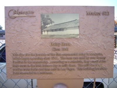
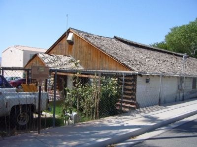
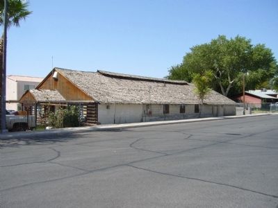
Dairy Barn
Circa 1941
Photographed by Bill Kirchner, August 29, 2011
1. Dairy Barn Marker
Erected by City of Mesquite. (Marker Number 23.)
Topics. This historical marker is listed in these topic lists: Agriculture • Animals. A significant historical year for this entry is 1941.
Location. 36° 48.154′ N, 114° 4.002′ W. Marker is in Mesquite, Nevada, in Clark County. It is on East 1st South, on the right when traveling east. Touch for map. Marker is at or near this postal address: 90 East 1st South, Mesquite NV 89027, United States of America. Touch for directions.

Regionally, this marker is in the Mojave Desert and in Greater Las Vegas. It is also in the American Southwest and in the Mountain West. Globally, it is in North America, the Western Hemisphere, the Western World, and the Anglosphere. Historically, it finds itself
this page online
Other nearby markers. At least 8 other markers are within walking distance of this marker: William Elias Abbott (about 400 feet away, measured in a direct line); Mary Jane Leavitt Abbott (about 400 feet away); History of Mesquite (about 500 feet away); Tithing Lot (about 500 feet away); Virgin Valley (about 800 feet away); Museum and Fire House (about 800 feet away); Abbott Way Station (about 800 feet away); William Abbott Home / Abbott Hotel (approx. 0.2 miles away). Touch for a list and map of all markers in Mesquite.
Photographed by Bill Kirchner, August 29, 2011
2. Dairy Barn Marker
Photographed by Bill Kirchner
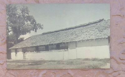
3. Close-Up of Photo Displayed on Marker
Photographed by Bill Kirchner, August 29, 2011
4. Dairy Barn
Credits. This page was last revised on December 20, 2020. It was originally submitted on September 1, 2011, by Bill Kirchner of Tucson, Arizona. This page has been viewed 839 times since then and 38 times this year. Photos: 1, 2, 3, 4. submitted on September 1, 2011, by Bill Kirchner of Tucson, Arizona. • Syd Whittle was the editor who published this page.
