Mesquite in Clark County, Nevada — The American Mountains (Southwest)
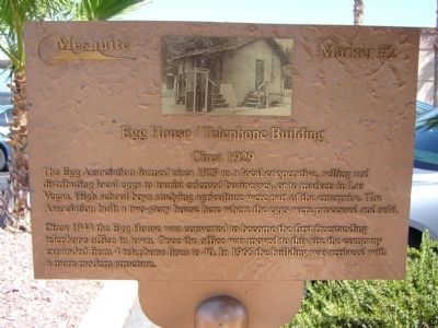
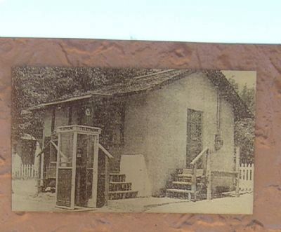
Egg House / Telephone Building
Circa 1929
Circa 1944 the Egg House was converted to become the first freestanding telephone office in town. Once the office was moved to this site the company expanded from 4 telephone lines to 40. In 1966 the building was replaced with a more modern structure.
Erected by City of Mesquite. (Marker Number 2.)
Topics. This historical marker is listed in these topic lists: Agriculture • Communications • Industry & Commerce. A significant historical year for this entry is 1929.
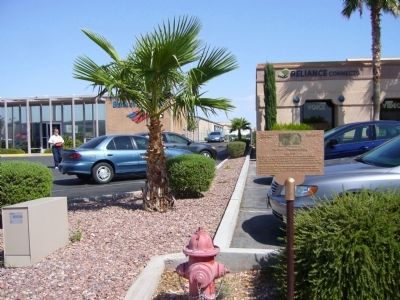
Location. 36° 48.245′ N, 114° 4.159′ W. Marker is in Mesquite, Nevada, in Clark County. Marker is on West Mesquite Boulevard, on the right when traveling west. Touch for map. Marker is at or near this postal address: 61 West Mesquite Boulevard, Mesquite NV 89027, United States of America. Touch for directions.
Other nearby markers. At least 8 other markers are within walking distance of this marker. The Old Spanish Trail (within shouting distance of this marker); Abbott Way Station (within shouting distance of this marker); Museum and Fire House (within shouting distance of this marker); Virgin Valley (within shouting distance of this marker); Tithing Lot (about 700 feet away, measured in a direct line); History of Mesquite (approx. 0.2 miles away); School and Gymnasium Block (approx. 0.2 miles away); William Elias Abbott (approx. 0.2 miles away). Touch for a list and map of all markers in Mesquite.
Credits. This page was last revised on June 16, 2016. It was originally submitted on September 1, 2011, by Bill Kirchner of Tucson, Arizona. This page has been viewed 578 times since then and 15 times this year. Photos: 1, 2, 3. submitted on September 1, 2011, by Bill Kirchner of Tucson, Arizona. • Syd Whittle was the editor who published this page.


