Bethlehem in Barrow County, Georgia — The American South (South Atlantic)
Bethlehem United Methodist Church
Inscription.
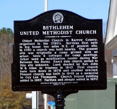
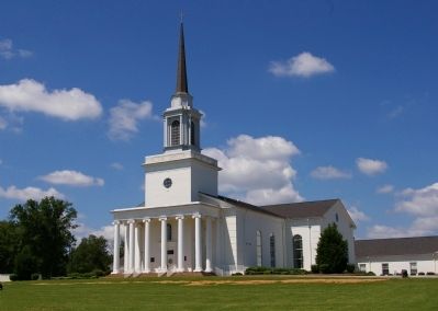
Oldest Methodist Church in Barrow County, organized in the 1780’s. Services first held two miles N.E. in log house. In 1790 a church was built nearby. The present site was originally a camp ground with an arbor, tents & cottages for camp meetings. Arbor used as mobilization center during War Between the States. Exact date church moved to this site unknown. Land deeded by Rev. John W. B. Allen to trustees in 1847. First church here torn down in 1878 and another erected. Present church was built in 1949 as a memorial to Guy Lee Thompson. Church School building added in 1967. Narthex and steeple added in 1970.
Erected 1977 by Bethlehem United Methodist Church and the Barrow County Historical Society.
Topics. This historical marker is listed in these topic lists: Churches & Religion • Education • War, US Civil. A significant historical year for this entry is 1790.
Location. 33° 56.167′ N, 83° 42.883′ W. Marker is in Bethlehem, Georgia, in Barrow County. Marker can be reached from the intersection of Christmas Avenue (Georgia Route 11) and Manger Avenue, on the right when traveling south. Touch for map. Marker is at or near this postal address: 709 Christmas Avenue, Bethlehem GA 30620, United States of America. Touch for directions.
Other nearby markers. At least 8 other markers are within 3 miles of this marker, measured as the crow flies. Charles O. Maddox (approx. 2.4 miles away); Marbury Creek Watershed Project (approx. 2.4 miles away); Russell House (approx. 2.9 miles away); Fort Yargo's Smokehouse (approx. 3 miles away); Fort Yargo's Beehive Oven (approx. 3 miles away); Fort Yargo's Log Structure (approx. 3 miles away); Fort Yargo's Cabin (approx. 3 miles away); Fort Yargo's Frontier Fences (approx. 3 miles away).
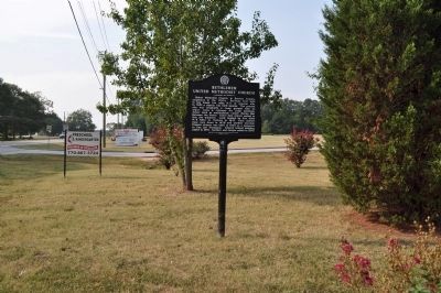
More about this marker. The church, and the marker, were originally located on Bethlehem Church Road at Manning Gin Road, and statements on the marker refer to that building. A new church building complex on Christmas Avenue was completed and dedicated in 2001, and the marker was installed at the rear of the church by the office. The original photograph was taken at that location.
By 2009 the marker had been removed and put in storage, as a major expansion of the church (adding a new Family Life Center, Contemporary Worship area, and new offices and additional space) made the original area inaccessible.
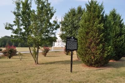
By 2011 the major expansion had been completed, and the marker had been reinstalled in a new (and logical) place, its third, at a front corner
of the church property. The location information and GPS coordinates reflect this new position.
Credits. This page was last revised on January 26, 2020. It was originally submitted on June 2, 2009, by David Seibert of Sandy Springs, Georgia. This page has been viewed 2,316 times since then and 38 times this year. Last updated on September 4, 2011, by David Seibert of Sandy Springs, Georgia. Photos: 1. submitted on June 2, 2009, by David Seibert of Sandy Springs, Georgia. 2, 3. submitted on September 4, 2011, by David Seibert of Sandy Springs, Georgia. 4. submitted on June 2, 2009, by David Seibert of Sandy Springs, Georgia. • Craig Swain was the editor who published this page.


