Merriam in Johnson County, Kansas — The American Midwest (Upper Plains)
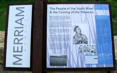
The People of the South Wind & the Coming of the Shawnee
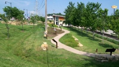
Merriam Historic Plaza Walking Path
Inscription.
From the late 1600ís until the early 1800ís, the Kansa (or Kaw) Indians lived in northeast Kansas. The Indian word Kansa means “People of the South Wind,” and both the state of Kansas and the Kansas River take their name from this tribe.
The Kansa culture was semi-nomadic. The men were hunters, trappers, and warriors. Kansa warriors were noted for their distinctive hairstyle consisting of a strip of hair on the top and back portions of the head. In addition to caring for the children, Kansa women planted, tended, and harvested crops and foraged for nuts, berries, and roots.
Beginning in the 1820ís, the Kansa surrendered their land through a succession of treaties and forced moves. The Kansa were designated land farther to the west and eventually settled on a reservation in Oklahoma.
Between 1826 and 1833, the Shawnee Indians were moved to the Kansas Territory from their original settlements in Ohio and Missouri. The Shawnee established themselves along the banks of the Kansas River and surrounding area, including tributaries such as Turkey Creek. The area had many springs, good timber, and stone suitable for building.
Regarded as skillful farmers, the Shawnee kept cattle, swine, oxen, and draft horses, and they were particularly known for the variety of fruits they raised. Contemporary accounts of Shawnee settlements noted fenced fields and log cabins. The Shawnee were also skilled craftsmen and prospered as traders with overland travelers.
About the Images
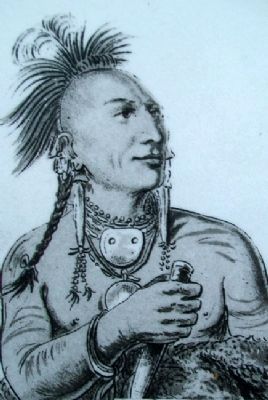
Little White Bear (Meach-o-shin-gaw) -
This portrait of a Kansa warrior, by artist George Catlin, typifies Catlinís memorable career. Probably painted at Fort Leavenworth in 1832, the original oil painting hangs in The Smithsonian. Catlin traveled extensively to Indian villages across the Midwest in the 1840ís. His paintings represent some of the most significant chronicles of Indian life and culture ever produced.
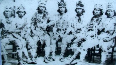
Shawnee War Party -
Black and white studio portrait of a group of Shawnee Native American men in ceremonial dress, circa 1860-1870
Indian Lands in Kansas -
The Shawnees were removed westward in the 1820ís and 1830ís to present day Kansas and exchanged their lands to the east for 1,600,000 acres in Kansas. In 1854, the Kansas-Nebraska Act established Kansas Territory and the Shawnees were allotted 200 acres on an individual basis. This reduced their holdings to about 200,000 acres.
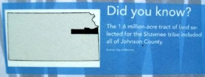
Did you know?
The 1.6 million-acre tract of land selected for the Shawnee tribe included all of Johnson County.
Erected 2006 by City of Merriam. (Marker Number 01.)
Topics. This
historical marker is listed in these topic lists: Agriculture • Government & Politics • Native Americans • Settlements & Settlers. A significant historical year for this entry is 1826.
Location. 39° 0.87′ N, 94° 41.453′ W. Marker is in Merriam, Kansas, in Johnson County. Marker is at the Merriam Visitors Bureau, near Exit #228B of Interstate 35, and immediately southwest of the intersection of Shawnee Mission Parkway (US 56) and Eby Avenue. Touch for map. Marker is at or near this postal address: 6304 East Frontage Road, Mission KS 66202, United States of America. Touch for directions.
Other nearby markers. At least 8 other markers are within walking distance of this marker. Shawnee Friends Mission (here, next to this marker); The Overland Trails (a few steps from this marker); The Founding of Campbellton (a few steps from this marker); Merriam Park & George Kessler (a few steps from this marker); The Trolley Line & Hocker Grove Amusement Park (within shouting distance of this marker); The Bear Pit (within shouting distance of this marker); Education in Merriam (within shouting distance of this marker); The South Park Community (within shouting distance of this marker). Touch for a list and map of all markers in Merriam.
Also see . . .
1. The Kaw Nation. People of the Southwind homepage (Submitted on September 4, 2011, by William Fischer, Jr. of Scranton, Pennsylvania.)
2. Kaws. Encyclopedia of the Great Plains entry (Submitted on September 4, 2011, by William Fischer, Jr. of Scranton, Pennsylvania.)
3. Eastern Shawnee Tribe of Oklahoma. Tribe homepage (Submitted on September 4, 2011, by William Fischer, Jr. of Scranton, Pennsylvania.)
4. Explore Merriam, Kansas. (Submitted on September 4, 2011, by William Fischer, Jr. of Scranton, Pennsylvania.)
Credits. This page was last revised on January 6, 2022. It was originally submitted on September 4, 2011, by William Fischer, Jr. of Scranton, Pennsylvania. This page has been viewed 1,518 times since then and 196 times this year. Photos: 1, 2, 3, 4, 5. submitted on September 4, 2011, by William Fischer, Jr. of Scranton, Pennsylvania. 6. submitted on September 6, 2011, by William Fischer, Jr. of Scranton, Pennsylvania.
