Foggy Bottom in Northwest Washington in Washington, District of Columbia — The American Northeast (Mid-Atlantic)
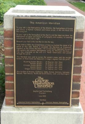
The American Meridian
To your left is the hemisphere of the Atlantic, the hemisphere of Europe and Africa, of Roman numerals and Indian script, of the Silk Road and the rising sun.
To your right is the hemisphere of the Pacific and the American West, the hemisphere of Japan and China, of calligraphy and rocketry, of towering volcanoes and the starry night.
Beneath your feet is the line that divides the two.
From 1848 to 1884, the United States of America marked the center of its world at this line. Before it accepted the Meridian at Greenwich, England, as the “Prime Meridian,” the United States separated the world into eastern and western hemispheres along the American Meridian, a line that originated at the old U.S. Naval Observatory and passed through this point.
This Meridian was used to survey the western states, and the straight borders of those states are measured in integral degrees from this point.
Wyoming Eastern Border: 29 Degrees (Am.) West
Western Border: 36 Degrees (Am.) West
Colorado Eastern Border: 27 Degrees (Am.) West
Western Border: 34 Degrees (Am.) West
Oregon Eastern Border: 42 Degrees (Am.) West
Also borders of Arizona, California, Idaho, Kansas, Montana, Nebraska, Nevada, New Mexico, North and South Dakota, Utah, and Washington.
Erected 2000 by The George Washington University.
Topics. This historical marker is listed in these topic lists: Government & Politics • Science & Medicine. A significant historical month for this entry is June 2000.
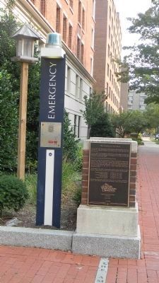
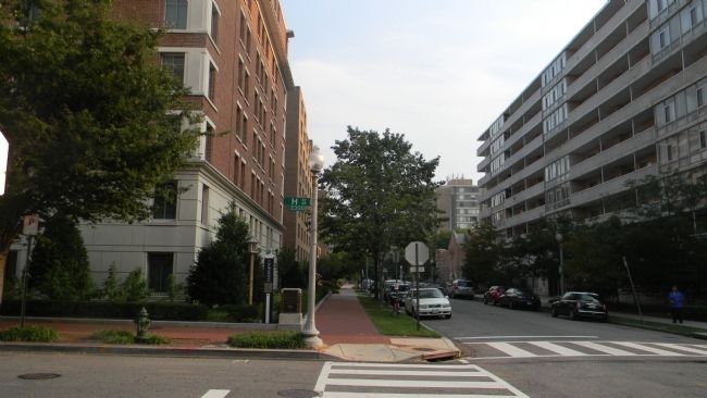
Location. 38° 53.97′ N, 77° 3.08′ W. Marker is in Northwest Washington in Washington, District of Columbia. It is in Foggy Bottom. Marker is at the intersection of 24th Street Northwest and H Street Northwest, on the left when traveling south on 24th Street Northwest. Touch for map. Marker is at or near this postal address: 2310 H Street Northwest, Washington DC 20037, United States of America. Touch for directions.
Other nearby markers. At least 8 other markers are within walking distance of this marker. Philip S. Amsterdam Hall (within shouting distance of this marker); Site of 2310 H Street, Northwest (within shouting distance of this marker); Saint Mary's Episcopal Church (about 300 feet away, measured in a direct line); St. Mary’s Episcopal Church (about 300 feet away); John A. Wilson, D.P.S. '92 (about 400 feet away); Liberty Baptist Church (about 500 feet away); Laszlo N. Tauber, M.D. (about 500 feet away); Julius Axelrod, PHD'55, LLD'71 (about 500 feet away). Touch for a list and map of all markers in Northwest Washington.
Related markers. Click here for a list of markers that are related to this marker. To better understand the relationship, study each marker in the order shown.
Also see . . .
1. Washington Meridian. Wikipedia entry:
Excerpt:
The ... meridian was through the clock room of the new Naval Observatory, 2.3 mi northwest of the White House, at 77°3'56.7"W (1897) or 77°4'2.24"W (NAD 27) or 77°4'1.16"W (NAD 83). The clock room is a small building at the exact center of the 1,000 ft (300 m) radius observatory grounds, whose northern entrance is at 34th Street and Massachusetts Avenue.(Submitted on September 5, 2011, by Richard E. Miller of Oxon Hill, Maryland.)
2. Establishing the 25th and 27th Meridians. The American Survetor website entry:
Excerpt:
The Act of September 28, 1850, (9 Stat. 515), provided that the meridian through the observatory at Washington would be adopted and used as the American meridian for all astronomic purposes. The meridian at Greenwich, England, however, would continue to be used for nautical purposes. The difference between the two meridians was 5 hours, 8 minutes, 12.15 seconds, or 77°03’02.3” of longitude.(Submitted on October 26, 2021.)
Additional keywords. geography; cartography; navigation

By flickr user DBKing (CC BY 2.0) via Wikimedia Commons, August 30, 2005
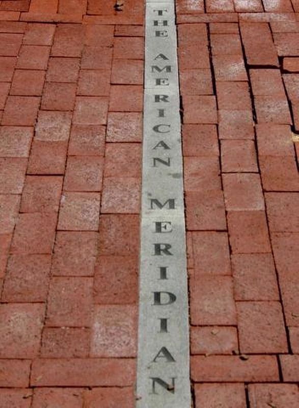
4. The American Meridian Line
On the sidewalk in front of the marker. If you follow the line 4 blocks south you'll find the Old Navy Observatory, from which the line was placed by federal law in 1850.
Credits. This page was last revised on January 30, 2023. It was originally submitted on September 5, 2011, by Richard E. Miller of Oxon Hill, Maryland. This page has been viewed 1,241 times since then and 71 times this year. It was the Marker of the Week September 18, 2022. Photos: 1, 2, 3. submitted on September 5, 2011, by Richard E. Miller of Oxon Hill, Maryland. 4. submitted on September 17, 2022, by J. J. Prats of Powell, Ohio. • Bernard Fisher was the editor who published this page.


