Near Gloucester Point in Gloucester County, Virginia — The American South (Mid-Atlantic)
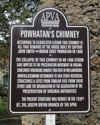
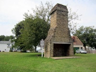
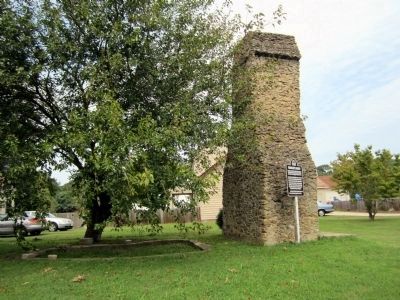
Powhatan’s Chimney
According to Gloucester legend this chimney is all that remains of the house built by Captain John Smith for Indian Chief Powhatan in 1609
The collapse of this chimney in an 1888 storm gave impetus to the preservation movement in Virginia Concerned Virginians banded together in Williamsburg Norfolk, Richmond determined to save other historical structures & sites from similar fate From their effort came the organization of the Association of the Preservation of Virginia Antiquities
The present structure was rebuilt in the 1930’s by..The Joseph Bryan Branch of the APVA
Erected by Association for the Preservation of Virginia Antiquities.
Topics. This historical marker is listed in these topic lists: Colonial Era • Native Americans. A significant historical year for this entry is 1609.
Location. 37° 17.498′ N, 76° 31.879′ W. Marker is near Gloucester Point, Virginia, in Gloucester County. Marker is on Pocahontas Lane south of Powhatan Drive (Virginia Route 1316), on the right when traveling south. Touch for map. Marker is at or near this postal address: 6509 Pocahontas Ln, Hayes VA 23072, United States of America. Touch for directions.
Other nearby markers. At least 8 other markers are within walking distance of this marker. Timberneck House Renovation at Machicomoco State Park (approx. half a mile away); Persistence (approx. half a mile away); Authority and Ceremony (approx. half a mile away); Peacemaking and Mobility (approx. half a mile away); Early Timberneck Graveyard (approx. half a mile away); Managing a Dynamic Landscape (approx. half a mile away); History and Community (approx. half a mile away); The Algonquian Landscape (approx. half a mile away).
Also see . . . Powhatan's Chimney. Wikipedia (Submitted on September 6, 2011, by Bernard Fisher of Richmond, Virginia.)
Credits. This page was last revised on February 11, 2022. It was originally submitted on September 6, 2011, by Bernard Fisher of Richmond, Virginia. This page has been viewed 1,526 times since then and 66 times this year. Photos: 1, 2, 3. submitted on September 6, 2011, by Bernard Fisher of Richmond, Virginia.


