Near Town of Russell in Bayfield County, Wisconsin — The American Midwest (Great Lakes)
Steamer Sevona
Historic Shipwreck
| — | Wisconsin's Maritime Trails | — |
Photographed by Paul Fehrenbach, August 23, 2011
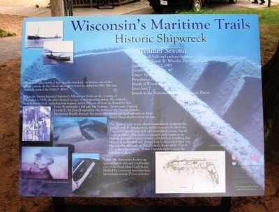
1. Steamer Sevona Marker
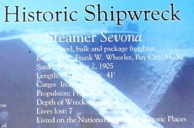
Type: Steel, bulk and package freighter
Built: 1890, Frank W. Wheeler, Bay City, Mich.
Sank: September 2, 1905
Length: 372’ Beam: 41’
Cargo: Iron ore
Propulsion: Propeller
Depth of Wreckage: 25’
Lives Lost: 7
Listed on the National Register of Historic Places
About four miles north of here lies the wreck of the Sevona, one of the largest carriers on the Great Lakes when it was launched in 1890. She was originally named the Emily P. Weed.
When the Sevona departed Superior’s Allouez ore docks on the evening of September 1, 1905, the skies showed no sign of an impending storm. She carried a crew of twenty-four, including four women, and 6,000 tons of iron ore, bound for Erie, Penn. By midnight a full gale was blowing. At two a.m., Captain Donald S. McDonald turned for the shelter of the Apostle Islands. Navigating blindly through the storm, the Sevona ran hard aground on Sand Island Shoal shortly before six a.m.
The Sevona broke in two almost immediately, trapping the captain and six men forward, unable to reach the lifeboats. They constructed makeshift rafts from hatch covers, but all seven perished. The
this page online
Today, the Sevona lies broken up, approximately one and a half miles east of the Sand Island Lighthouse. Marked by a seasonal mooring buoy, her remains rest in 25 feet of water.
Erected by Wisconsin Historical Society.
Topics and series. This historical marker is listed in this topic list: Waterways & Vessels. In addition, it is included in the Wisconsin’s Maritime Trails series list. A significant historical month for this entry is September 2006.
Location. 46° 56.806′ N, 90° 53.389′ W. Marker is near Town of Russell, Wisconsin, in Bayfield County. It can be reached from Little Sand Bay Road half a mile west of Allen Road. Marker is located at Little Sand Bay Boat Launch, Apostle Islands National Lakeshore, in the parking lot at the end of Little Sand Bay Road. Touch for map. Marker is at or near this postal address: 32660 Little
Photographed by Paul Fehrenbach, August 23, 2011
2. Steamer Sevona Marker
Top section with ship information

Regionally, this marker is on the North Shore. It is also in the American Midwest, in the Corn Belt, and on Lake Superior’s South Shore Region. Globally, it is in North America, in the Great North Woods, on the Great Lakes, in the Western Hemisphere, in the Western World, and in the Anglosphere. Historically, it finds itself in what was once the territory of the Mississippian Culture and also the Northwest Territory.
Other nearby markers. At least 8 other markers are within 10 miles of this marker, measured as the crow flies: Hokenson Brothers Fishery (within shouting distance of this marker); A Family Affair (within shouting distance of this marker); …the Forest for the Trees (within shouting distance of this marker); Boom, Bust, and try to Adjust (within shouting distance of this marker); Living on the Edge (within shouting distance of this marker); The Twilight Fishermen (about 300 feet away, measured in a direct line); Cultural Fire Returns to Stockton Island (approx. 9.8 miles away); Bayfield Historic Waterfront (approx. 10 miles away).
Photographed by Paul Fehrenbach, August 22, 2011
3. Steamer Sevona Marker
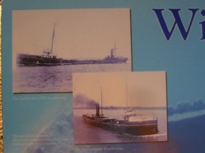
Close up of photos in upper left corner
More about this marker. On the upper left are photos of "The Sevona before 1905 lengthening" & "The Sevona after 1905 lengthening". Historical photos courtesy of Historical Collections of the Great Lakes, Bowling Green State University
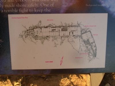
On the lower left are several underwater images by Tamara Thomsen and on the lower right is an "Archaeological Site Plan". The background image is labeled "Background image: bow".
Also see . . . Wreck of the Sevona. Apostle Islands National Lakeshore (Submitted on September 8, 2011, by Paul Fehrenbach of Richfield, Wisconsin.)
Additional keywords. Shipwrecks Steamer Sevona
Photographed by Paul Fehrenbach, August 22, 2011
4. Steamer Sevona Marker
Archaeological Site Plan
Photographed by Paul Fehrenbach, August 22, 2011
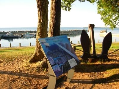
5. Steamer Sevona Marker
Looking out toward Sand Bay
Credits. This page was last revised on July 3, 2021. It was originally submitted on September 7, 2011, by Paul Fehrenbach of Richfield, Wisconsin. This page has been viewed 1,210 times since then and 49 times this year. Photos: 1, 2, 3, 4, 5. submitted on September 7, 2011, by Paul Fehrenbach of Richfield, Wisconsin. • Bernard Fisher was the editor who published this page.
