Foggy Bottom in Northwest Washington in Washington, District of Columbia — The American Northeast (Mid-Atlantic)
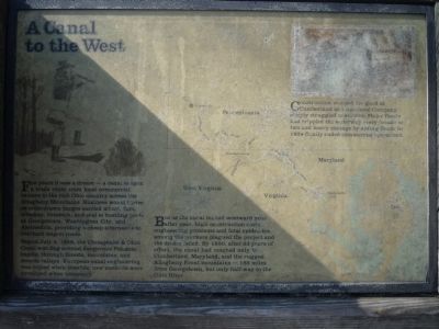
A Canal to the West
For years it was a dream – a canal to open a trade route from local commercial centers to the rich Ohio country across the Allegheny Mountains. Business would thrive as mule-drawn barges carried wheat, furs, whiskey, livestock, and coal to bustling ports at Georgetown, Washington City, and Alexandria, providing a cheap alternative to overload wagon roads.
Begun July 4, 1828, the Chesapeake & Ohio Canal was dug around dangerous Potomac rapids, through forests, mountains, and remote valleys, European canal engineering was copied when possible; new methods were developed when necessary.
But as the canal inched westward year after year, high construction costs, engineering problems and fatal epidemics among the workers plagued the project and the dream faded. By 1850, after 22 years of effort, the canal had reached only to Cumberland, Maryland, and the Allegheny Front mountains—185 miles from Georgetown, but only half-way to the Ohio River.
Construction stopped for good at Cumberland and the Canal Company simply struggled to survive. Major floods had crippled the waterway every decade or two and heavy damage by spring floods in 1924 finally ended commercial operations.
Erected by National Park Service, U.S. Department of the Interior.
Topics and series. This historical marker is listed in these topic lists: Industry & Commerce • Waterways & Vessels. In addition, it is included in the Chesapeake and Ohio (C&O) Canal series list. A significant historical date for this entry is July 4, 1828.
Location. 38° 53.982′ N, 77° 3.428′ W. Marker is in Northwest Washington in Washington, District of Columbia. It is in Foggy Bottom. Marker is on Rock Creek and Potomac Parkway Northwest, 0.1 miles south of Virginia Avenue Northwest, on the right when traveling south. Located on the Rock Creek Park Trail. Touch for map. Marker is at or near this postal address: 2700 Virginia Avenue Northwest, Washington DC 20037, United States of America. Touch for directions.
Other nearby markers. At least 8 other markers are within walking distance of this marker. Tide Lock (here, next to this marker); Tide Lock and Rock Creek Basin (within shouting distance of this marker); The Watergate Hotel (about 600 feet away, measured in a direct line); Herring Highway (about 600 feet away); Benito Juárez Memorial (approx. 0.2 miles away); History Preserved and Adapted (approx. 0.2 miles away); Godey's Lime Kilns (approx. ¼ mile away); Chesapeake and Ohio Canal (approx. 0.3 miles away). Touch for a list and map of all markers in Northwest Washington.
More about this marker. In
the center of Panel 1 is a map of the planned route of the Chesapeake & Ohio Canal from Washington, D.C. to Pittsburgh, PA.
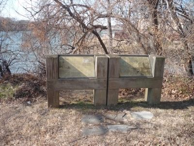
On the left of Panel 2 is a "you are here" map showing the location of Tide Lock and the Rock Creek Basin. On the right is an illustration of, "The old Georgetown Waterfront, looking upriver."
Related marker. Click here for another marker that is related to this marker.
Additional keywords. John F. Kennedy Memorial Center for the Performing Arts; Watergate.
Credits. This page was last revised on January 30, 2023. It was originally submitted on February 19, 2011, by Richard E. Miller of Oxon Hill, Maryland. This page has been viewed 1,350 times since then and 16 times this year. Last updated on September 8, 2011, by Richard E. Miller of Oxon Hill, Maryland. Photos: 1, 2, 3, 4. submitted on February 19, 2011, by Richard E. Miller of Oxon Hill, Maryland. • Bill Pfingsten was the editor who published this page.


