New Franklin in Howard County, Missouri — The American Midwest (Upper Plains)
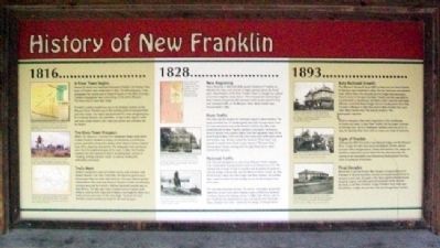
History of New Franklin
1816
A River Town Begins
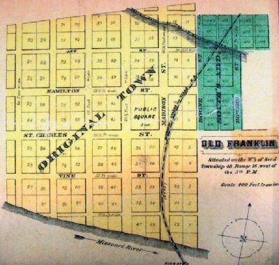
Named for American statesman Benjamin Franklin, the frontier river town of Franklin was established in 1816. The following year, it was designated the county seat of Howard County. In the blink of an eye, Franklin's population was 1,000 strong. In the entire Missouri Territory, only St. Louis was larger.
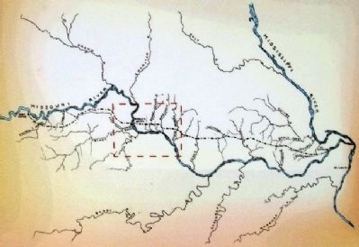
Franklin's sudden growth was due to its strategic location on the Missouri River. Franklin was at the meeting point of overland trails and river routes. The region had good soils for crops and good grass for livestock. Boone's Lick saltworks - origin of the region's name and now a state historic site - was just upriver and provided salt for export.
The River Town Prospers
When The Missouri Intelligencer newspaper began publication in 1819, Franklin included 13 shops, 120 log homes, a courthouse, prison, post office, drug store, barber shop, tobacco factory, federal land office, physician and dentist. The newspaper and courthouse were the first established west of St. Louis. In 1820, the Franklin Academy for Girls opened its doors, providing basic courses in "reading, writing and plain work," as well as needlework, embroidery and piano.
Trails Meet
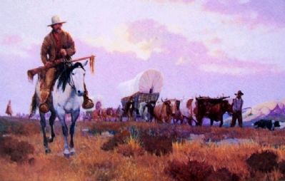
Eastern immigrants came to Franklin via the well-traveled, well-known Boone's Lick Trail. Until 1821, the Spanish government discouraged Mexican trade with America. That year, Mexico gained independence (the same year Missouri became a state). Immediately, entrepreneurs led by Franklin's William Becknell traveled west to New Mexico. The two-way trade included scores of goods: pork, tobacco, cutlery, cloth, traps and trinkets in exchange for silver, furs, mules, horses and wool. Profits were high. The Santa Fe Trail became a major commercial route for the next 50 years.
1828
New Beginning
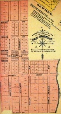
Heavy flooding in 1826 and 1828 caused residents of Franklin to abandon the town and relocate to higher ground above the flood-plain. Shareholders of the New Franklin Town Co. bought 240 upland acres from neighbor James Alcorn. The transplanted community of New Franklin prospered with overland traffic on the Santa Fe Trail and riverboat traffic on the Missouri River. New Franklin was incorporated in 1835.
River Traffic
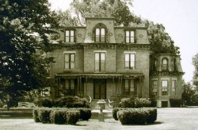
This time was the heyday for riverboats based in New Franklin. The boats provided tons of needed goods and vital transportation from St. Louis and points east to the western frontier. By 1864, Capt. Joseph Kinney of New Franklin owned 21 riverboats. He found a piec of ground only slightly higher than the highwater mark of the great flood of 1844. There he had a fine home built with exotic wood and marble. Capt. Kinney named
the mansion "Rivercene," and boasted it would never flood. Locals named it "Kinney's Folly." Kinney wasn't proven wrong until the 1993 flood, when water enterd the mansion.
Railroad Traffic
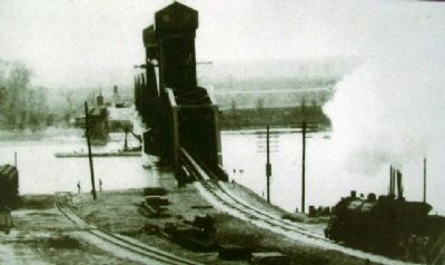
Over the next 20 years or so, the unruly Missouri River changed from a vital water transportation route to an obstacle to cross. The railroad had arrived. It took six months and $1 million to build the railroad bridge at Boonville over the Missouri River. On Jan. 10, 1874, the first train rolled over this bridge into New Franklin. Six months later, crews finished the Eads Bridge across the Mississippi River at St. Louis.
The railroads expanded quickly. The barber, shoemaker, gristmiller, sawmiller, grocers and saloon keepers saw no difference between riverboat money and railway money. In 1882, Capt. Kinney sold his last riverboat; the steamboat era was nearing the end. Railroads - faster, cheaper and safer - were the new kings of transportation.
1893
Katy Railroad Growth
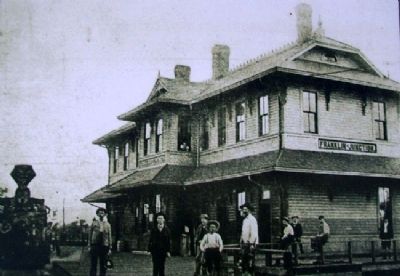
The Missouri, Kansas & Texas (MKT or Katy) rail line from Franklin to Machens was completed in 1893. Like the riverboats and overland trails before them, the railroads carried freight and passengers from St. Louis to the west. By 1906, Franklin Junction was built to accommodate a roundhouse, turntable, water reservoir and depot. Officials moved the Katy's freight division
headquarters from New Franklin to Mokane in 1907, then back to New Franklin two years later. New Franklin was "the natural location," the newspaper reported.
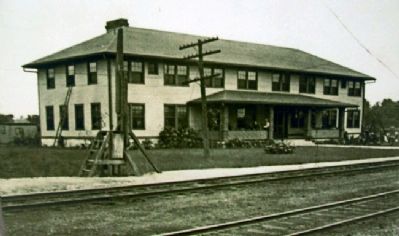
Within a few years, there were expansions to the roundhouse, turntable and depot. In 1920, New Franklin had the largest icehouse on the Katy line - 60 to 70 employees handled 4,000 tons of ice. In 1923, the $40,000 Katy Hotel, with 40 rooms, was ready for business.
Signs of Trouble
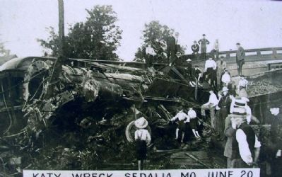
Although the MKT line built a new railroad bridge over the Missouri River in 1932, the Katy had occasional setbacks. Strikes, almost constant office reorganization, deadly train wrecks, fires, wage cuts, workforce reductions up and down the line, and especially the coming of the automobile and devastating floods pushed the Katy closer to going out of business.
Final Decades
World War II and the Korean War brought increased demand for transport of oil and munitions, but also increased wear and tear on equipment and rails. Droughts in the 1950s significantly decreased shipping of grain and other agricultural goods. As the railroad declined, so did New Franklin. In 1957, Franklin's Katy Hotel was demolished. In 1986, the last Katy train ran through New Franklin.
Erected by Missouri Dept of Natural Resources.
Topics. This historical marker is listed in this
topic list: Settlements & Settlers. A significant historical month for this entry is January 1860.
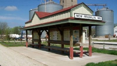
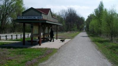
Location. 39° 0.749′ N, 92° 44.14′ W. Marker is in New Franklin, Missouri, in Howard County. Marker is at the Katy Trail State Park kiosk (Mile Post 188) at the south end of Howard Street, about 500 feet east of Missouri Street (Missouri Route 5). Touch for map. Marker is in this post office area: New Franklin MO 65274, United States of America. Touch for directions.
Other nearby markers. At least 8 other markers are within walking distance of this marker. Santa Fe Trail (here, next to this marker); The New Franklin Viaduct (about 500 feet away, measured in a direct line); KATY Caboose #127 (approx. 0.3 miles away); Franklin (approx. 0.3 miles away); Franklin and New Franklin (approx. 0.3 miles away); End of Boone's Lick Trail (approx. 0.3 miles away); City of Trails (approx. 0.3 miles away); Santa Fe Trail Marker (approx. 0.3 miles away). Touch for a list and map of all markers in New Franklin.
Also see . . .
1. Katy Trail State Park. (Submitted on September 9, 2011, by William Fischer, Jr. of Scranton, Pennsylvania.)
2. New Franklin, Missouri. (Submitted on September 9, 2011, by William Fischer, Jr. of Scranton, Pennsylvania.)
3. New Franklin on the Katy Trail. (Submitted on September 9, 2011, by William Fischer, Jr. of Scranton, Pennsylvania.)
Photographed By Unknown, undated
8. Photo on History of New Franklin Marker
[Caption reads] Rivercene mansion is Victorian Second Empire style, same as the Missouri Governor's Mansion. Its slate mansard roof is one of the earliest in this part of the country. Used by permission, State Historical Society of Missouri, Columbia.
Photographed By Unknown, undated
10. Photo on History of New Franklin Marker
[Caption reads] Located at an intersection of two of the Katy's routes, Franklin Junction was the ideal location for a depot, roundhouse, turntable, reservoir and for a freight division headquarters. Courtesy of Wayne Lammers.
Credits. This page was last revised on June 16, 2016. It was originally submitted on September 8, 2011, by William Fischer, Jr. of Scranton, Pennsylvania. This page has been viewed 1,149 times since then and 89 times this year. Photos: 1, 2, 3, 4, 5, 6, 7, 8, 9, 10, 11, 12. submitted on September 9, 2011, by William Fischer, Jr. of Scranton, Pennsylvania.
