Dover in Kent County, Delaware — The American Northeast (Mid-Atlantic)
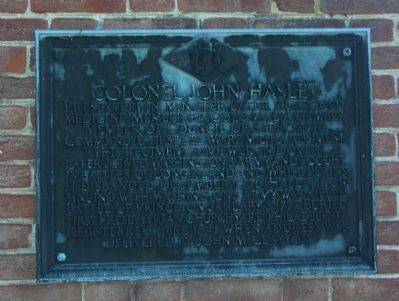
Colonel John Haslet
Photographed by Roger Dean Meyer, October 9, 2006
1. Colonel John Haslet Marker
Erected 1932 by Historic Marker Commission. (Marker Number KC-A7.)
Topics and series. This historical marker is listed in these topic lists: Religion & Religious Structures • Science & Medicine • War, US Revolutionary. In addition, it is included in the Delaware Public Archives series list. A significant historical date for this entry is January 3, 1777.
Location. 39° 9.366′ N, 75° 31.602′ W. Marker is in Dover, Delaware, in Kent County. It can be reached from South Governors Avenue 0.1 miles south of W North Street, on the right when traveling south. The marker is located on the left side of the entrance to Meeting
this page online

Regionally, this marker is in the American Mid-Atlantic, on the Delmarva Peninsula, and on the Eastern Seaboard. Globally, it is in the North Atlantic Region, North America, the Western Hemisphere, the Western World, and the Anglosphere. Historically, it finds itself in what was once New Netherland, one of the original Thirteen Colonies, and the Antebellum South.
Other nearby markers. At least 8 other markers are within walking distance of this marker: John M. Clayton (here, next to this marker); Old Presbyterian Church (here, next to this marker); Site of Kent County’s First Presbyterian Church (a few steps from this marker); Continuity & Progress (about 400 feet away, measured in a direct line); Did you know… (about 400 feet away); Site of Dover's First Methodist Church (about 700 feet away); The Capitol Theater (approx. 0.2 miles away); The Golden Fleece Tavern (approx. 0.2 miles away). Touch for a list and map
Photographed by Roger Dean Meyer
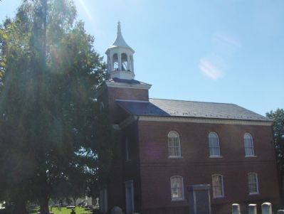
2. Meeting House Gallery 1, The Old Presbyterian Church
More about this marker. Although there is no number on the marker itself, the updated online records of the Delaware Public Archives list this marker as being number "KC-A7".
Also see . . . Wikipedia entry for John Haslet. (Submitted on January 14, 2008, by Roger Dean Meyer of Yankton, South Dakota.)
Credits. This page was last revised on November 21, 2024. It was originally submitted on January 14, 2008, by Roger Dean Meyer of Yankton, South Dakota. This page has been viewed 3,072 times since then and 33 times this year. Photos: 1. submitted on January 14, 2008, by Roger Dean Meyer of Yankton, South Dakota. 2. submitted on January 15, 2008, by Roger Dean Meyer of Yankton, South Dakota.
