King William in King William County, Virginia — The American South (Mid-Atlantic)
Acquinton Church
A Colonial Church Built in 1734

Photographed by Bernard Fisher, September 14, 2011
1. Acquinton Church Marker
it was used by various denominations
as a meeting house prior to 1888
when it was sold to the Methodists.
A deed conveying the property is
recorded at King William Court House
Erected 1968 by Interested friends.
Topics. This historical marker is listed in these topic lists: Colonial Era • Religion & Religious Structures. A significant historical year for this entry is 1888.
Location. 37° 40.819′ N, 77° 3.458′ W. Marker is in King William, Virginia, in King William County. It is at the intersection of Acquinton Church Road (Virginia Route 618) and Jacks Creek Road (Route 629), on the left when traveling south on Acquinton Church Road. Touch for map. Marker is in this post office area: King William VA 23086, United States of America. Touch for directions.

Regionally, this marker is on the Middle Peninsula. It is also in the American South, specifically in the Upper South, in the Tidewater, in the Chesapeake Bay Region, and on the Eastern Seaboard. Globally, it is in the North Atlantic Region, North America, the Western Hemisphere, the Western World, and the Anglosphere.
this page online
Other nearby markers. At least 8 other markers are within 3 miles of this marker, measured as the crow flies: King William Training School (approx. 1.7 miles away); King William Courthouse (approx. 2.4 miles away); "Racial Integrity" and the Tribes of King William (approx. 2½ miles away); King William County Courthouse (approx. 2½ miles away); Henry Jenner Jones (approx. 2½ miles away); King William Confederate Monument (approx. 2½ miles away); a different marker also named King William Courthouse (approx. 2½ miles away); Henry Fox (approx. 2½ miles away). Touch for a list and map of all markers in King William.
Also see . . . A brief history of Acquinton Church. King William Historical Society (Submitted on September 14, 2011.)
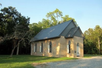
Photographed by Bernard Fisher, September 14, 2011
2. Acquinton Church
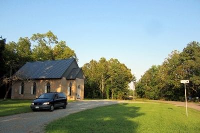
Photographed by Bernard Fisher, September 14, 2011
3. Rt 618 & Rt 629
Credits. This page was last revised on November 9, 2021. It was originally submitted on September 14, 2011, by Bernard Fisher of Richmond, Virginia. This page has been viewed 1,270 times since then and 82 times this year. Photos: 1, 2, 3. submitted on September 14, 2011, by Bernard Fisher of Richmond, Virginia.
