Marker Logo
THE HISTORICAL
MARKER DATABASE
“Bite-Size Bits of Local, National, and Global History”
Couderay in Sawyer County, Wisconsin — The American Midwest (Great Lakes)
 

Court Oreilles
 
 
Court Oreilles Marker image. Click for full size.
Photographed by Keith L, September 17, 2011
1. Court Oreilles Marker
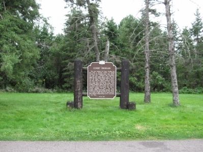
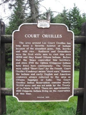
Inscription. The area around Lac Court Oreilles has long been a favorite habitat of Indians because of the abundant game, fish, berries and wild rice. Radisson and Groseilliers were the first white men to visit this area (1659) and they found Ottawa Indians. Before that the Sioux controlled this territory, and since 1745 the Ojibwa (Chippewa) Indians have lived here continuously. The Ottawa were called "Short Ears" by the French. Court Oreilles (Couderay) means "short ears." However, the Indians and early English and American explorers always referred to the area as Ottawa Sagaigan or Lake. The Court Oreilles Indian Reservation contains nearly 70,000 acres and was set aside by the Treaty of La Pointe in 1854. There are approximately 1500 Chippewa Indians living on the reservation at this time.

Erected 1955

 
Erected 1955 by the Wisconsin Historical Society. (Marker Number 39.)
 
Topics and series. This historical marker is listed in these topic lists: ExplorationIndigenous Peoples and Communities. In addition, it is included in the Wisconsin Historical Society series list. A significant historical year for this entry is 1745.
 
Location. 45° 47.79′ N,
Paid Advertisement
Click or scan to see
this page online
91° 18.046′ W. Marker is in Couderay, Wisconsin, in Sawyer County. It is at the intersection of State Highway 27 / 70 and Valesh Street, on the right when traveling east on State Highway 27 / 70. Marker is at a highway pull-off. Touch for map. Marker is in this post office area: Couderay WI 54828, United States of America. Touch for directions.

Regionally, this marker is in Northern Wisconsin. It is also in the American Midwest, on the Great Lakes, and in the Corn Belt. Globally, it is in North America, the Great North Woods, the Western Hemisphere, the Western World, and the Anglosphere. Historically, it finds itself in what was once the territory of the Mississippian Culture and also the Northwest Territory.

Other nearby markers. At least 4 other markers are within 14 miles of this marker, measured as the crow flies: Pierre Esprit Radisson and Medard Groseilliers (approx. 5.9 miles away); St. Francis Solanus Indian Mission (approx. 7.6 miles away); The Chippewa Flowage (approx. 10.8 miles away); Namekagon - Court Oreilles Portage (approx. 13.3 miles away).
 
Also see . . .  Lac Courte Oreilles.
Court Oreilles Marker image. Click for full size.
Photographed by Keith L, September 17, 2011
2. Court Oreilles Marker
Wikipedia entry. (Submitted on September 18, 2011.) 
 
Court Oreilles Marker image. Click for full size.
Photographed by Keith L, September 17, 2011
3. Court Oreilles Marker
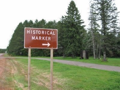
The Tubby Forest Marker can be seen in the distance near the highway.
Nearby Marker image. Click for full size.
Photographed by Keith L, September 17, 2011
4. Nearby Marker
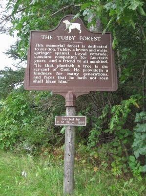
The Tubby Forest
This memorial forest is dedicated to our dog, Tubby, a brown and white springer spaniel. Loyal comrade, constant companion for fourteen years, and a friend to all mankind. "He that planteth a tree is the servant of God. He provideth a kindness for many generations, and faces that he hath not seen shall bless him."
Erected by C.M. Olson, 1956
 
 
Credits. This page was last revised on November 13, 2020. It was originally submitted on September 18, 2011, by Keith L of Wisconsin Rapids, Wisconsin. This page has been viewed 1,481 times since then and 50 times this year. Photos:   1, 2, 3, 4. submitted on September 18, 2011, by Keith L of Wisconsin Rapids, Wisconsin.

m=47318

CeraNet Cloud Computing sponsors the Historical Marker Database.
This website earns income from purchases you make after using our links to Amazon.com. We appreciate your support.
Paid Advertisement
Jul. 7, 2026