Topeka in Shawnee County, Kansas — The American Midwest (Upper Plains)
Charles Curtis
Vice-President, United States
| — | 1929 - 1933 | — |
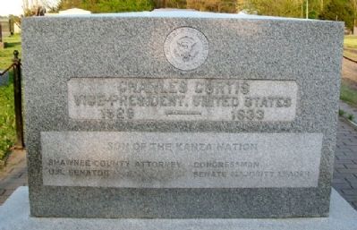
Photographed by William Fischer, Jr., April 29, 2011
1. Charles Curtis Marker
Shawnee County Attorney
Congressman
U.S. Senator
Senate Majority Leader
Charles Curtis
1860 - 1936
Topics. This historical marker is listed in these topic lists: Government & Politics • Indigenous Peoples and Communities. A significant historical year for this entry is 1860.
Location. 39° 2.322′ N, 95° 39.11′ W. Marker is in Topeka, Kansas, in Shawnee County. It can be reached from Southeast California Avenue. Marker is in Section 80 of Topeka Cemetery. Touch for map. Marker is at or near this postal address: 1601 SE 10th Avenue, Topeka KS 66607, United States of America. Touch for directions.

Regionally, this marker is in Eastern Kansas. It is also in the American Midwest, in the Corn Belt, on the prairies, and on the Southern Plains. Globally, it is in North America, the Western Hemisphere, the Western World, and the Anglosphere. Historically, it finds itself in what was once the Louisiana Purchase.
Other nearby markers. At least 8 other markers are within 2 miles of this marker, measured as the crow flies: Topeka Tornado Victims (about 500 feet away, measured in a direct
this page online
Also see . . .
1. Charles Curtis. (Submitted on September 18, 2011, by William Fischer, Jr. of Reynoldsburg, Ohio.)
2. Charles Curtis. (Submitted on September 18, 2011, by William Fischer, Jr. of Reynoldsburg, Ohio.)
3. Charles Curtis. (Submitted on September 18, 2011, by William Fischer, Jr. of Reynoldsburg, Ohio.)
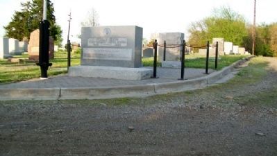
Photographed by William Fischer, Jr., April 29, 2011
2. Charles Curtis Marker
Looking east
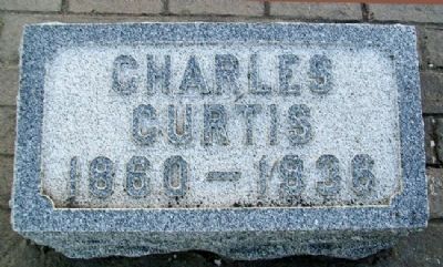
Photographed by William Fischer, Jr., April 29, 2011
3. Charles Curtis Grave Marker
Credits. This page was last revised on February 24, 2026. It was originally submitted on September 18, 2011, by William Fischer, Jr. of Reynoldsburg, Ohio. This page has been viewed 985 times since then and 35 times this year. Photos: 1, 2, 3. submitted on September 18, 2011, by William Fischer, Jr. of Reynoldsburg, Ohio.
