Julesburg in Sedgwick County, Colorado — The American Mountains (Southwest)
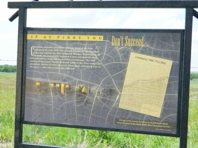
If at First You Don't Succeed
Photographed by Beverly Pfingsten, June 13, 2011
1. If at First You Don't Succeed Marker
The site of the second Julesburg is on private property along the bank of the South Platte River just north of here.
Map
Julesburg, 1866, Plat Map
Topics. This historical marker is listed in these topic lists: Indigenous Peoples and Communities • Settlements & Settlers. A significant historical year for this entry is 1865.
Location. 40° 56.536′ N, 102° 17.764′ W. Marker is in Julesburg, Colorado, in Sedgwick County. It is on County Route 28 2.9 miles west of U.S. 385, on the right when traveling west. Touch for map. Marker is in this post office area: Julesburg CO 80737, United States of America. Touch for directions.
Regionally, this marker is in the Eastern Plains.
this page online
Other nearby markers. At least 8 other markers are within 3 miles of this marker, measured as the crow flies: Blowing in the Wind (approx. half a mile away); Devil’s Dive (approx. 2 miles away); Transcontinental Railroad (approx. 2.6 miles away); The Pony Express Trail (approx. 2.9 miles away); Water - Lifeblood of the West (approx. 2.9 miles away); A Moving Experience (approx. 2.9 miles away); Pony Express, Telegraph and Railroad (approx. 2.9 miles away); Overland City (Julesburg) Pony Express Riders (approx. 2.9 miles away). Touch for a list and map of all markers in Julesburg.
Other markers no longer nearby. Colorado's Wildlife Story (was approx. 2.9 miles away but has been permanently removed); Last Days of the Buffalo (was approx. 2.9 miles away but has been permanently removed); Welcome to Colorado (was approx. 2.9 miles away but has been permanently
Photographed by Beverly Pfingsten, June 13, 2011
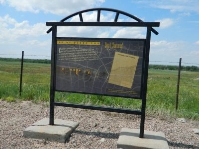
2. If at First You Don't Succeed Marker
Credits. This page was last revised on June 16, 2016. It was originally submitted on September 19, 2011, by Bill Pfingsten of Bel Air, Maryland. This page has been viewed 757 times since then and 24 times this year. Photos: 1, 2. submitted on September 19, 2011, by Bill Pfingsten of Bel Air, Maryland.
