St. Augustine in St. Johns County, Florida — The American South (South Atlantic)
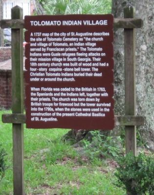
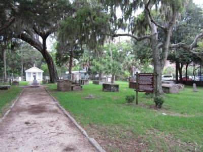
Tolomato Indian Village
When Florida was ceded to the British in 1763, the Spaniards and the Indians left, together with their priests. The church was torn down by British troops for firewood but the tower survived into the 1790s, when the stones were used in the construction of present day Cathedral Basilica of St. Augustine.
Topics. This historical marker is listed in these topic lists: Cemeteries & Burial Sites • Churches & Religion • Native Americans. A significant historical year for this entry is 1737.
Location. 29° 53.823′ N, 81° 18.911′ W. Marker is in St. Augustine, Florida, in St. Johns County. Marker is on Cordova Street, on the right when traveling south. Located in Tolomato Cemetery. Touch for map. Marker is in this post office area: Saint Augustine FL 32084, United States of America. Touch for directions.
Other nearby markers. At least 8 other markers are within walking distance of this marker. Tolomato Cemetery (within shouting distance of this marker); The Rosario Defense Line (within shouting distance of this marker); The 1886 Old Drugstore (within shouting distance of this marker); Santo Domingo Redoubt (about 300 feet away, measured in a direct line); a different marker also named Santo Domingo Redoubt (about 300 feet away); a different marker also named Santo Domingo Redoubt (about 300 feet away); a different marker also named Santo Domingo Redoubt (about 300 feet away); Orange Street School (about 300 feet away). Touch for a list and map of all markers in St. Augustine.
Credits. This page was last revised on January 2, 2019. It was originally submitted on September 19, 2011, by Craig Swain of Leesburg, Virginia. This page has been viewed 838 times since then and 38 times this year. Photos: 1, 2. submitted on September 19, 2011, by Craig Swain of Leesburg, Virginia.

