Southport in Brunswick County, North Carolina — The American South (South Atlantic)
Fort Johnston
Photographed by J. J. Prats, January 15, 2008
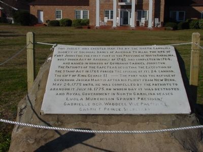
1. Fort Johntson Marker
This tablet was erected May, 1911 by the North Carolina Society of Colonial Dames of America to mark the site of Fort Johnston, the first fort in the Province of North Carolina, built under Act of Assembly of 1745 and completed 1764, and named in honour of Governor Gabriel Johnston. The Patriots of the Cape Fear resisting the execution of the Stamp Act in 1766 forced the spiking of its 24 cannon, the gift of King George II.
The fort was the refuge of Governor Josiah Martin after his flight from New Bern, May 24, 1775 until he was compelled by the patriots to abandon it July 18, 1775, on which day it was destroyed and Royal Government in North Carolina ceased.
Erected 1911 by The North Carolina Society of Colonial Dames of America, Luola Murchison Sprunt, President; Gabrielle deR. Waddell, Vice President; Carrie E. Prince, Secretary.
Topics and series. This historical marker is listed in these topic lists: Colonial Era • War, US Revolutionary. In addition, it is included in the The Colonial Dames of America, National Society of series list. A significant historical year for this entry is 1911.
Location. 33° 55.052′ N, 78° 1.043′ W.
this page online

Regionally, this marker is in the Coastal Plain and on the Cape Fear Coast. It is also in the American South, specifically in the Upper South, in the Tidewater, and on the Eastern Seaboard. Globally, it is in the North Atlantic Region, North America, the Western Hemisphere, the Western World, and the Anglosphere. Historically, it finds itself in what was once the territory of the Mississippian Culture, one of the original Thirteen Colonies, one of the Confederate States of America, and the Antebellum South.
Other nearby markers. At least 8 other markers are within walking distance of this marker: Bald Head Lighthouse (a few steps from this marker); Josiah Martin (a few steps from this marker); a different marker also named Fort Johnston (within shouting distance of this marker); (Map of the First 100 Lots) (within shouting distance of this marker); Mrs. Jessie Stevens Taylor
Photographed by J. J. Prats, January 15, 2008
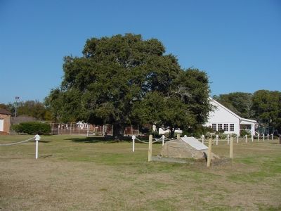
2. Fort Johntson Marker
Also see . . . Fort Johnson. NCpedia entry (Submitted on February 7, 2021, by Larry Gertner of New York, New York.)
Photographed by J. J. Prats, January 15, 2008
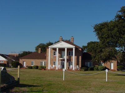
3. Fort Jackson Barracks Today
Credits. This page was last revised on February 7, 2021. It was originally submitted on January 15, 2008, by J. J. Prats of Powell, Ohio. This page has been viewed 2,413 times since then and 39 times this year. Photos: 1, 2, 3. submitted on January 15, 2008, by J. J. Prats of Powell, Ohio.
