Near Kittanning in Armstrong County, Pennsylvania — The American Northeast (Mid-Atlantic)
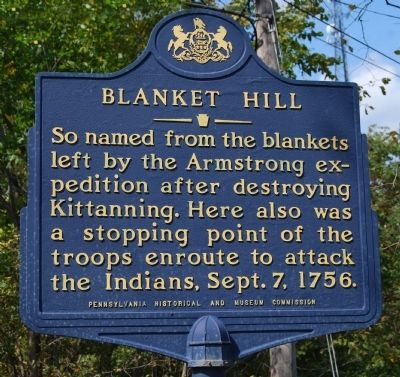
Blanket Hill
Erected 1946 by Pennsylvania Historical and Museum Commission.
Topics and series. This historical marker is listed in these topic lists: Native Americans • War, French and Indian. In addition, it is included in the Pennsylvania Historical and Museum Commission series list. A significant historical month for this entry is September 1900.
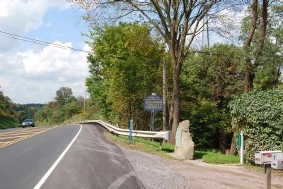
Location. 40° 45.894′ N, 79° 25.001′ W. Marker is near Kittanning, Pennsylvania, in Armstrong County. Marker is on Benjamin Franklin Highway (U.S. 422) 0.3 miles east of Simpson Church Road, on the right when traveling west. Touch for map. Marker is in this post office area: Kittanning PA 16201, United States of America. Touch for directions.
Other nearby markers. At least 8 other markers are within 7 miles of this marker, measured as the crow flies. A different marker also named Blanket Hill (here, next to this marker); Fort Armstrong (approx. 5.7 miles away); Kittanning (approx. 6 miles away); Pittsburgh Plate Glass Ford City Works (approx. 6.1 miles away); Armstrong County (approx. 6.3 miles away); In Memory of General John Armstrong (approx. 6.3 miles away); Kittanning or Attiqué Indian Town (approx. 6.4 miles away); Armstrong County Civil War Memorial (approx. 6.4 miles away). Touch for a list and map of all markers in Kittanning.
Credits. This page was last revised on June 16, 2016. It was originally submitted on September 25, 2011, by Mike Wintermantel of Pittsburgh, Pennsylvania. This page has been viewed 1,461 times since then and 171 times this year. Photos: 1, 2. submitted on September 25, 2011, by Mike Wintermantel of Pittsburgh, Pennsylvania.

