Near Thomasville in Clarke County, Alabama — The American South (East South Central)
Airmount Grave Shelter And Cemetery
Inscription.
Front:
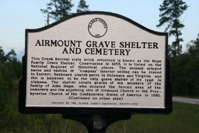
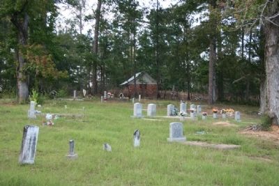
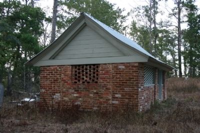
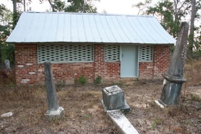
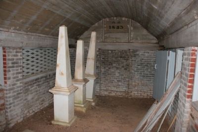
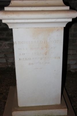
This Greek Revival style brick structure is known as the Hope Family Grave Shelter. Constructed in 1853, it is listed on the National Register of Historical places. The unusual splayed eaves and vaulted or “compass” interior ceiling can be traced to Eastern Seaboard church yards in Delaware and Virginia, and this is believed to the only grave shelter of its type in Alabama. The shelter covers graves of six members of the family of John Hope, who donated the fenced area of the cemetery and the adjoining site of Airmount Church to the Presbyterian Church of the Confederate States of America in 1862.
(Continued on other side)
Reverse:
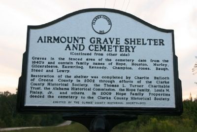
(Continued from other side)
Graves in the fenced area of the cemetery date from the 1840’s and contain family names of Hope, Houston, Murley, Gildersleeve, Easterling, Kennedy, Champion, Jones, Baugh, Steed, and Lowry.
Restoration of the shelter was completed by Charlie Bulloch of Greene County in 2002 through efforts of the Clarke County Historical Society, the Thomas L. Turner Charitable Trust, the Alabama Historical Commission, the Hope family, Louis M. Finlay, Jr., and others. In 2009 Hope Family Properties deeded the cemetery to the Clarke County Historical Society.
Erected 2010 by Clarke County Historical Society.
Topics. This historical marker is listed in this topic list: Cemeteries & Burial Sites. A significant historical year for this entry is 1853.
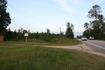
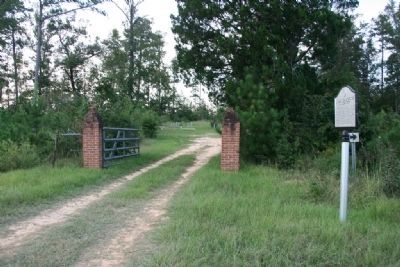
Location. 31° 58.084′ N, 87° 40.164′ W. Marker is near Thomasville, Alabama, in Clarke County. Marker is on State Highway 5, one mile south of State Route 25, on the right when traveling south. Touch for map. Marker is in this post office area: Thomasville AL 36784, United States of America. Touch for directions.
Other nearby markers. At least 8 other markers are within 12 miles of this marker, measured as the crow flies. Pine Hill, Alabama (approx. 4.9 miles away); Thomasville's Early History (approx. 5.4 miles away); Thomasville War Memorial (approx. 5.4 miles away); Williams’ Temple CME Church (approx. 5˝ miles away); Choctaw Corner (approx. 9˝ miles away); Office of Joel Desaker Jones (approx. 9.6 miles away); Shiloh Baptist Church (approx. 10.9 miles away); Tallahatta Springs (approx. 11.3 miles away). Touch for a list and map of all markers in Thomasville.
Also see . . .
1. Clarke County Alabama website. (Submitted on September 26, 2011, by Timothy Carr of Birmingham, Alabama.)
2. Wikipedia entry on the Airmount Grave Shelter. (Submitted on April 19, 2020, by Mark Hilton of Montgomery, Alabama.)
Credits. This page was last revised on April 19, 2020. It was originally submitted on September 26, 2011, by Timothy Carr of Birmingham, Alabama. This page has been viewed 1,250 times since then and 43 times this year. Photos: 1, 2, 3, 4, 5, 6, 7, 8, 9. submitted on September 26, 2011, by Timothy Carr of Birmingham, Alabama. • Bill Pfingsten was the editor who published this page.
