Old Fort in Polk County, Tennessee — The American South (East South Central)
McNair's Stand
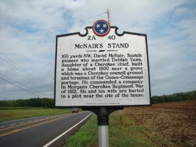
Photographed by Judith Barber, September 23, 2011
1. McNair's Stand Marker
Erected by Tennessee Historical Commission. (Marker Number 2A 40.)
Topics and series. This historical marker is listed in these topic lists: Indigenous Peoples and Communities • Settlements & Settlers. In addition, it is included in the Tennessee Historical Commission series list. A significant historical year for this entry is 1800.
Location. Marker is missing. It was located near 35° 0.31′ N, 84° 44.047′ W. Marker was in Old Fort, Tennessee, in Polk County. It was on Busted Rock Rd.. Only post and cap are at location. Touch for map. Marker was at or near this postal address: 871 Busted Rock Rd, Old Fort TN 37362, United States of America. Touch for directions.

Regionally, this marker was in East Tennessee. It was also in the American South, specifically in the Upper
this page online
Other nearby markers. At least 8 other markers are within 11 miles of this location, measured as the crow flies: Tennessee / Georgia (approx. 1.2 miles away); Old Federal Road (approx. 1.6 miles away in Georgia); Marr’s Fort (approx. 3½ miles away); Ocoee Dam #1 (approx. 7.8 miles away); Ocoee No. 1 (approx. 7.9 miles away); a different marker also named Ocoee No. 1 (approx. 7.9 miles away); Civil War "No Man's Land" (approx. 10½ miles away); Red Clay Council Ground (approx. 11 miles away).
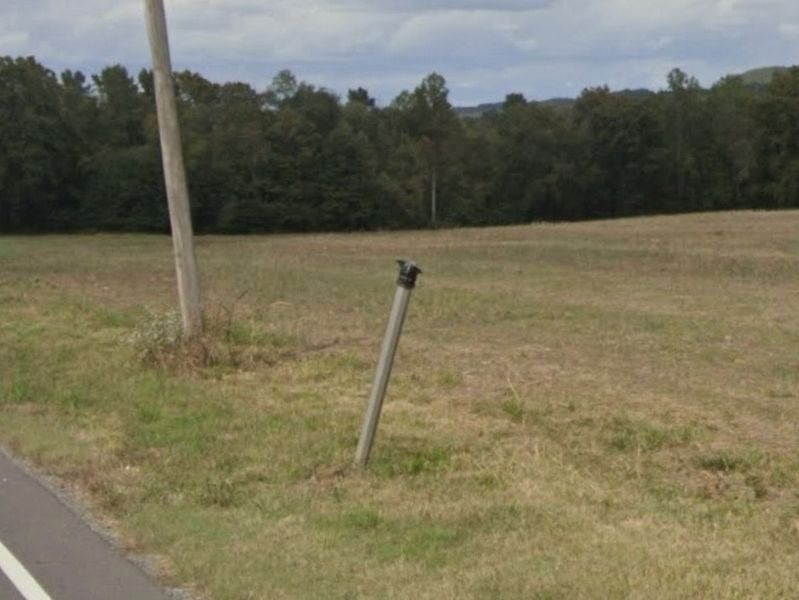
Photographed by Tim Fillmon, October 27, 2025
2. McNair's Stand Broken Marker
Credits. This page was last revised on October 27, 2025. It was originally submitted on September 28, 2011, by Judith Barber of Marietta, Georgia. This page has been viewed 1,866 times since then and 69 times this year. Photos: 1. submitted on September 28, 2011, by Judith Barber of Marietta, Georgia. 2. submitted on October 27, 2025, by Tim Fillmon of Webster, Florida. • Bill Pfingsten was the editor who published this page.
