Pocotaligo in Jasper County, South Carolina — The American South (South Atlantic)
The Battle of Pocotaligo
Photographed by Michael Stroud, January 2008
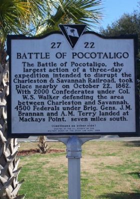
1. The Battle of Pocotaligo Marker Front Side
The Battle of Pocotaligo, the largest action of a three-day expedition intended to disrupt the Charleston & Savannah Railroad, took place nearby on October 22, 1862. With 2000 Confederates under Col. W.S. Walker defending the area between Charleston and Savannah, 4500 Federals under Brig. Gens. J.M. Brannon and A.M. Terry landed at Mackays Point, seven miles south.
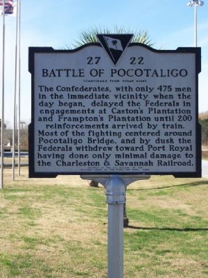
The Confederates with only 475 men in the immediate vicinity when the day began, delayed the Federals in engagements at Caston's Plantation until 200 reinforcements arrived by train. Most of the fighting centered around Pocataligo Bridge, and by dusk the Federals withdrew toward Port Royal having done only minimal damage to the Charleston & Savannah Railroad.
Erected 2002 by South Carolina Department of Archives and History; sponsored by S.C. Society of the Military Order of the Stars and Bars. (Marker Number 27-22.)
Topics. This historical marker is listed in these topic lists: Railroads & Streetcars • War, US Civil. A significant historical month for this entry is October 1864.
Location. 32° 37.919′ N, 80° 52.553′ W. Marker is in Pocotaligo, South Carolina,
this page online

Regionally, this marker is in the Lowcountry, in the Ashepoo and Combahee and Edisto Basin. It is also in the American South, specifically in the Deep South, and on the Eastern Seaboard. Globally, it is in the North Atlantic Region, North America, the Western Hemisphere, the Western World, and the Anglosphere. Historically, it finds itself in what was once New Spain, the territory of the Mississippian Culture, one of the original Thirteen Colonies, one of the Confederate States of America, and the Antebellum South.
Other nearby markers. At least 8 other markers are within walking distance of this marker: General Robert E. Lee / Fighting Near Coosawhatchie (about 600 feet away, measured in a direct line); The Frampton Lines / John Edward Frampton House (approx. 0.2 miles away); Cabbage Palmetto (approx. 0.2 miles away); This is Jim Wescott's Wishing Well
Photographed by Michael Stroud, January 2008
2. The Battle of Pocotaligo Marker Back Side
Regarding The Battle of Pocotaligo. Pocotaligo being on the Charleston and Savannah railroad, the only railroad in this section of the country at this time. The modern railroad bed runs generally north-south about a mile west of the marker location.
Additional commentary.
1. 1845 Pocataligo
I have an 1845 map of Colleton District with Walterborough, Red Bank and Pocataligo in Prince William District as the only settlements. A road ran from St George south to Red Bank (Canadys Crossroads) and on to Walterborough and south to Collins X-roads leading to Pocataligo on the Coosawahatchee River. The Only Railroad in the area was the Charleston & Hamburg at St George which was in Colleton District at that time. It ran northwest to Rieves, BranchV and Midway.
As such, Pocatalico was the biggest settlement in the south-west part of Prince William District at this time before 1850. The road west went to Savannah, while the road east
Photographed by Michael Stroud, January 15, 2008
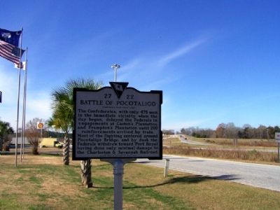
3. I-95 Interchange 33 in S.C.
— Submitted July 26, 2018, by tom Fetters of Lombard, Illinois.
Credits. This page was last revised on September 1, 2026. It was originally submitted on January 16, 2008, by Mike Stroud of Bluffton, South Carolina. This page has been viewed 9,753 times since then and 331 times this year. Photos: 1, 2, 3. submitted on January 16, 2008, by Mike Stroud of Bluffton, South Carolina. • Craig Swain was the editor who published this page.
