Greensburg in Westmoreland County, Pennsylvania — The American Northeast (Mid-Atlantic)
Toll House
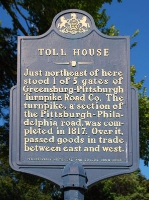
Photographed by Mike Wintermantel, October 7, 2011
1. Toll House Marker
Erected 1955 by Pennsylvania Historical and Museum Commission.
Topics and series. This historical marker is listed in this topic list: Roads & Vehicles. In addition, it is included in the Pennsylvania Historical and Museum Commission (PHMC) series list. A significant historical year for this entry is 1817.
Location. 40° 18.378′ N, 79° 34.186′ W. Marker is in Greensburg, Pennsylvania, in Westmoreland County. It is at the intersection of Tollgate Hill Road and Mount Odin Park Entrance, on the right when traveling east on Tollgate Hill Road. Touch for map. Marker is in this post office area: Greensburg PA 15601, United States of America. Touch for directions.

Regionally, this marker is in the Laurel Highlands and in Greater Pittsburgh. It is also in the American Northeast, in the Mid-Atlantic, in Appalachia, and specifically in Northern Appalachia. Globally, it is in North America, the Western
this page online
Other nearby markers. At least 8 other markers are within 2 miles of this marker, measured as the crow flies: Greensburg (approx. 0.6 miles away); Mother Ann Regina Ennis (approx. 0.7 miles away); Mother M. Aloysia Lowe (approx. 0.7 miles away); Westmoreland County Memorial Park Veterans Monument (approx. 0.7 miles away); Mother Elizabeth Ann Seton (approx. ¾ mile away); 9/11 Memorial (approx. ¾ mile away); Sisters of Charity of Seton Hill (approx. 1.1 miles away); Hempfield Township (approx. 1.2 miles away). Touch for a list and map of all markers in Greensburg.
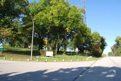
Photographed by Mike Wintermantel, October 7, 2011
2. Toll House Marker
Credits. This page was last revised on June 16, 2016. It was originally submitted on October 7, 2011, by Mike Wintermantel of Pittsburgh, Pennsylvania. This page has been viewed 882 times since then and 51 times this year. Photos: 1, 2. submitted on October 7, 2011, by Mike Wintermantel of Pittsburgh, Pennsylvania.
