
Near Warrenton in Fauquier County, Virginia — The American South (Mid-Atlantic)
Second Manassas Campaign
Manassas Junction Operations
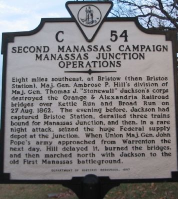
Photographed by Craig Swain, January 12, 2008
1. Second Manassas Campaign Manassas Junction Operations Marker
Erected 1997 by Department of Historic Resources. (Marker Number C-54.)
Topics and series. This historical marker is listed in this topic list: War, US Civil. In addition, it is included in the Virginia Department of Historic Resources (DHR) series list. A significant historical date for this entry is August 27, 1862.
Location. 38° 45.971′ N, 77° 43.038′ W. Marker is near Warrenton, Virginia, in Fauquier County. It is at the intersection of Lee Highway / Alexandria Turnpike (U.S. 15/29) and Broad Run Church
this page online

Regionally, this marker is in the Washington Metropolitan Area and in Northern Virginia. It is also in the American South, specifically in the Upper South, and in the Mid-Atlantic. Globally, it is in North America, the Western Hemisphere, the Western World, and the Anglosphere. Historically, it finds itself in what was once the territory of the Mississippian Culture, one of the original Thirteen Colonies, one of the Confederate States of America, and the Antebellum South.
Other nearby markers. At least 8 other markers are within 3 miles of this marker, measured as the crow flies: Buckland Mills Battle (approx. 2.1 miles away); Christ's Chapel on Baldwin Ridge (approx. 2.4 miles away); Buckland (approx. 2½ miles away); The Buckland Mill (approx. 2.6 miles away); The Buckland Plan (approx. 2.6 miles away); Lafayette's Tour (approx. 2.6 miles away); Grapewood Farm Engagement
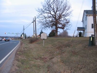
Photographed by Craig Swain, January 12, 2008
2. Second Manassas Campaign Manassas Junction Operations Marker
More about this marker. This marker replaced a late 1920s marker with the same title and number which read “Eight miles southeast, near Bristoe, Stonewall Jackson destroyed a railroad bridge over this stream as he moved to the rear of Pope’s army, August 26, 1862. Reaching Manassas, Pope’s supply depot, he destroyed vast quantities or stores.” The old marker was marked missing in Margaret Peters’ 1985 Guidebook to Virginia’s Historical Makers.
Also see . . .
1. Animated Overview of the Second Manassas Campaign. An excellent visual guide through the campaign leading up to the battle of Second Masassas. The action described on the marker is part of the early phases of this campaign. (Submitted on January 17, 2008, by Craig Swain of Leesburg, Virginia.)
2. Timeline of the Second Manassas Campaign. The events described on the marker occurred around 26-27 August 1862. (Submitted on January 17, 2008, by Craig Swain of Leesburg, Virginia.)
3. Broad Run Baptist Church. Short history of the nearby church. (Submitted on January 17, 2008, by Craig Swain of Leesburg, Virginia.)
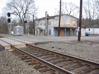
Photographed by Craig Swain, December 22, 2007
3. Bristoe Station
To the south is the town of Bristoe, the location of the old Bristoe Station. Jackson's troops wrecked trains here prior to destroying nearby bridges and moving towards Manassas Junction.
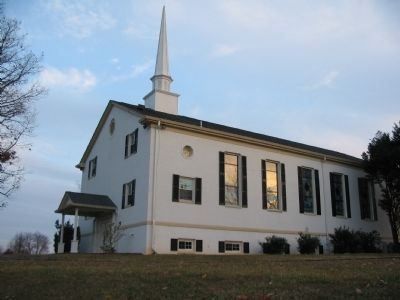
Photographed by Craig Swain, January 12, 2008
4. The Broad Run Baptist Church
Near the marker is the Broad Run Baptist Church. The church dates to the 18th century, but the original was burned during the Civil War.
Credits. This page was last revised on June 16, 2016. It was originally submitted on January 17, 2008, by Craig Swain of Leesburg, Virginia. This page has been viewed 3,032 times since then and 53 times this year. Photos: 1, 2, 3, 4. submitted on January 17, 2008, by Craig Swain of Leesburg, Virginia.
