Downtown Seattle in King County, Washington — The American West (Northwest)
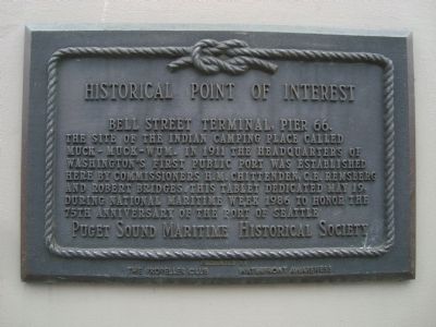
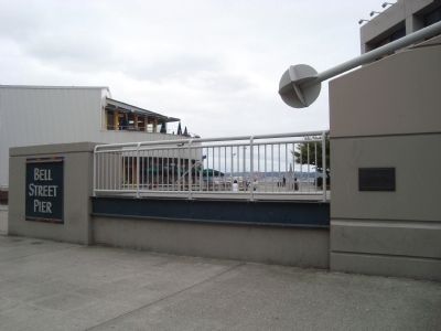
Bell Street Terminal, Pier 66
Historical Point of Interest
Erected 1986 by Puget Sound Maritime Historical Society and The Propeller Club • Waterfront Awareness.
Topics. This historical marker is listed in these topic lists: Industry & Commerce • Native Americans • Waterways & Vessels. A significant historical date for this entry is May 19, 1908.
Location. 47° 36.671′ N, 122° 20.909′ W. Marker is in Seattle, Washington, in King County. It is in Downtown Seattle. Marker is on Akaskan Way, on the right when traveling south. Touch for map. Marker is at or near this postal address: 2333 Alaskan Way, Seattle WA 98101, United States of America. Touch for directions.
Other nearby markers. At least 8 other markers are within walking distance of this marker. Seattle-Galway Stone (within shouting distance of this marker); Bell Street Bridge (within shouting distance of this marker); Why Are the Piers Angled? (about 500 feet away, measured in a direct line); Where did this bridge used to go? / Where does this bridge go now? (about 800 feet away); Belltown Pan (approx. 0.2 miles away); “Great White Fleet” (approx. 0.2 miles away); Austin A. Bell Building (approx. 0.2 miles away); Guiry/Schillestad Buildings (approx. 0.2 miles away). Touch for a list and map of all markers in Seattle.
Credits. This page was last revised on February 7, 2023. It was originally submitted on October 9, 2011, by Barry Swackhamer of Brentwood, California. This page has been viewed 641 times since then and 19 times this year. Photos: 1, 2. submitted on October 9, 2011, by Barry Swackhamer of Brentwood, California. • Syd Whittle was the editor who published this page.

