Marlborough in Middlesex County, Massachusetts — The American Northeast (New England)
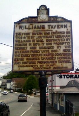
Williams Tavern
1630 - 1930
Erected 1930 by Massachusetts Bay Colony-Tercentenary Commission.
Topics and series. This historical marker is listed in these topic lists: Colonial Era • Government & Politics • Native Americans • Settlements & Settlers. In addition, it is included in the Massachusetts Bay Colony—Tercentenary Commission Markers series list. A significant historical year for this entry is 1665.
Location. 42° 20.367′ N, 71° 33.699′ W. Marker is in Marlborough, Massachusetts, in Middlesex County. Marker is at the intersection of Lakeside Ave (Massachusetts Route 20) and Williams Street, on the right when traveling east on Lakeside Ave. Touch for map. Marker is in this post office area: Marlborough MA 01752, United States of America. Touch for directions.
Other nearby markers. At least 8 other markers are within 3 miles of this marker, measured as the crow flies. Lieut Wm. Munroe Brigham Jr. Park (approx. 0.6 miles away); The Volunteer (approx. 0.6 miles away); Robert W. "Red" Touchette (approx. 0.6 miles away); High School Common (approx. 0.7 miles away); Doughboy Monument (approx. 0.7 miles away); Gen. Henry Knox Trail (approx. ¾ mile away); The John Brown Bell (approx. one mile away); Mary Goodnow's Grave (approx. 2.3 miles away). Touch for a list and map of all markers in Marlborough.
Also see . . .
1. Original 1930 publication by the Commonwealth of Massachusetts of Tercentenary Commission Markers. Original 1930 publication by the Commonwealth of Massachusetts of Tercentenary Commission Markers, commemorating the three hundredth anniversary of the Massachusetts Bay Colony. (Submitted on May 21, 2011, by Russell Chaffee Bixby of Bernardston, Massachusetts.)
2. The Marlborough Historical Society. The Marlborough Historical Society, founded in 1964, is an all-volunteer, non-profit organization dedicated to historic preservation, education, and celebration in Marlborough. (Submitted on November 6, 2011, by Russell Chaffee Bixby of Bernardston, Massachusetts.)
Credits. This page was last revised on June 16, 2016. It was originally submitted on April 28, 2010, by Antonio Prats of Shrewsbury, Massachusetts. This page has been viewed 1,586 times since then and 77 times this year. Last updated on October 9, 2011, by Michael Tiernan of Danvers, Massachusetts. Photo 1. submitted on April 28, 2010, by Antonio Prats of Shrewsbury, Massachusetts. • Bill Pfingsten was the editor who published this page.
