Near Hampton in Hampton County, South Carolina — The American South (South Atlantic)
Old Pocotaligo Road, March From The Sea
Photographed by Michael Stroud, January 2008
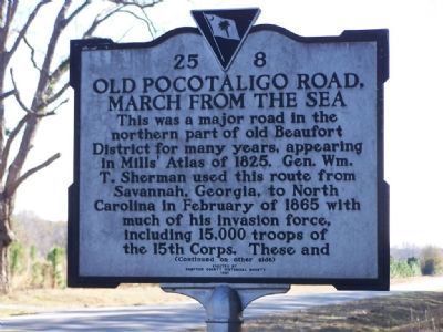
1. Old Pocotaligo Road, March from the Sea Marker
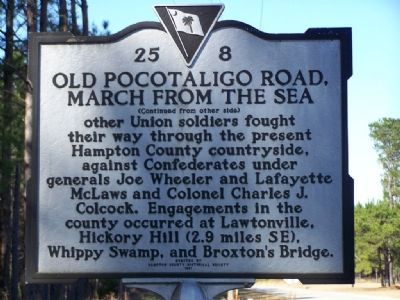
This was a major road in the northern part of old Beaufort District for many years, appearing in Mill's Atlas of 1825. Gen. Wm. T. Sherman used this route from Savannah, Georgia, to North Carolina in February of 1865 with much of his invasion force, including 15,000 troops of the 15th Corps. These and other Union soldiers fought their way through the present Hampton County countryside, against Confederates under generals Joe Wheeler and Lafayette McLaws and Colonel Charles J. Colcock. Engagements in the county occurred at Lawtonville, Hickory Hill (2.9 miles SE), Whippy Swamp, and Broxton's Bridge.
Erected 1991 by South Carolina Department of Archives and History; sponsored by Hampton County Historical Society. (Marker Number 25-8.)
Topics. This historical marker is listed in this topic list: War, US Civil. A significant historical month for this entry is February 1865.
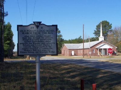
Location. 32° 50.553′ N, 81° 7.487′ W. Marker is near Hampton, South Carolina, in Hampton County. It is at the intersection of Pocotaligo Road (County Route 68) and Savannah Highway (U.S. 601), on the left when traveling south on Pocotaligo Road. Located on Pocotaligo
this page online

Regionally, this marker is in the Lowcountry, in the Ashepoo and Combahee and Edisto Basin. It is also in the American South, specifically in the Deep South, and on the Eastern Seaboard. Globally, it is in the North Atlantic Region, North America, the Western Hemisphere, the Western World, and the Anglosphere. Historically, it finds itself in what was once New Spain, the territory of the Mississippian Culture, one of the original Thirteen Colonies, one of the Confederate States of America, and the Antebellum South.
Other nearby markers. At least 8 other markers are within 2 miles of this marker, measured as the crow flies: Hampton County Jail (approx. 1.8 miles away); Hampton Colored School (approx. 1.8 miles away); a different marker also named Hampton Colored School (approx. 1.8 miles away); Miles McSweeney Home Site (approx. 1.9 miles away); All Wars Memorial (approx. 1.9 miles away); Supreme Sacrifice Memorial (approx. 1.9 miles away); POW-MIA Memorial (approx.
Photographed by Michael Stroud, January 2008
2. Old Pocotaligo Road, March from the Sea Marker (reverse)
Also see . . .
1. Rivers' Bridge,Hickory Hill, Lawtonville :Civil War South Carolina American Civil War. (Submitted on January 18, 2008, by Mike Stroud of Bluffton, South Carolina.)
2. South Carolina Information Highway. Crocketville and Miley, Ehrhardt, S.C. ,Family members of the area formed this troop called the Whippy Swamp Guards (Submitted on January 18, 2008, by Mike Stroud of Bluffton, South Carolina.)
Additional commentary.
1. Union victory
McLaws retreated toward Branchville after stalling Sherman's advance for only one day.
— Submitted January 18, 2008, by Mike Stroud of Bluffton, South Carolina.
Photographed by Michael Stroud, January 2008
3. The Intersection , Marker Located on Pocotaligo Road
Credits. This page was last revised on May 31, 2026. It was originally submitted on January 18, 2008, by Mike Stroud of Bluffton, South Carolina. This page has been viewed 2,499 times since then and 54 times this year. Photos: 1, 2, 3. submitted on January 18, 2008, by Mike Stroud of Bluffton, South Carolina. • Craig Swain was the editor who published this page.
