Lexington, Virginia — The American South (Mid-Atlantic)
Lexington
”Shells went through the houses”
— Hunter's Raid —
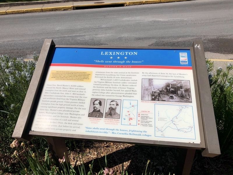
(Preface):On May 26, 1864, Union Gen. David Hunter marched south from Cedar Creek near Winchester to drive out Confederate forces, lay waste to the Shenandoah Valley, and destroy transportation facilities at Lynchburg. His raid was part of Gen. Ulysses S. Grant’s strategy to attack Confederates simultaneously throughout Virginia. After defeating Gen. William E. “Grumble” Jones at Piedmont on June 5, Hunter marched to Lexington, burned Virginia Military Institute, and headed to Lynchburg. There, on June 17-18 Gen. Jubal A. Early repulsed Hunter and pursued him to West Virginia. Early then turned north in July to threaten Washington.
Union General David Hunter’s 18,000 soldiers crossed the North (Maury) River and entered Lexington from the north and west on June 11, 1864. Confederate Gen. John C. McCausland’s skirmishers contested the crossing near the river and artillerists fired from the Virginia Military Institute parade ground. Union gunners shelled Lexington from the high ground north of town, causing significant property damage. For the next three days, Hunter’s men plundered private homes, Washington College (now Washington and Lee University), and the Institute. Hunter also ordered the destruction of a mill and several warehouses at Jordan’s Point, the dock and terminus of the canal system. Just before his arrival, six barges loaded with private property and armaments from the state arsenal at the Institute departed for Lynchburg, but Union cavalrymen destroyed the flotilla 10 miles downstream.
McCausland’s 1,400 Confederates (including Virginia Military Institute cadets) retreated toward Lynchburg. On June 12, Hunter ordered the Institute and the home of former Virginia governor John Letcher burned, but spared Washington College after administrators pleaded that the school was named for George Washington. By the afternoon of June 14, the last of Hunter’s army had departed Lexington for Lynchburg.
"Some shells went through the houses, frightening the inhabitants terribly."
- Mrs. Cornellia McDonald, refugee
Erected by Virginia Civil War Trails.
Topics and series. This historical marker is listed in this topic list: War, US Civil. In addition, it is included in the Virginia Civil War Trails series list. A significant historical month for this entry is May 1865.
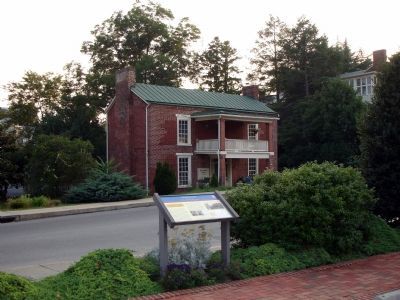
Location. 37° 47.058′ N, 79° 26.438′ W. Marker is in Lexington, Virginia. Marker is on East Washington Street, on the left when traveling east. The marker is located at the Lexington and Rockbridge Area Visitor Center. Touch for map. Marker is at or near this postal address: 106 East Washington Street, Lexington VA 24450, United States of America. Touch for directions.
Other nearby markers. At least 8 other markers are within walking distance of this marker. The Sloan House, ca. 1844-45 (a few steps from this marker); Gen. Samuel Houston (within shouting distance of this marker); Ruth McCulloch (within shouting distance of this marker); Campbell House, ca. 1845 (within shouting distance of this marker); Phil "Old Dixie" Nunn (within shouting distance of this marker); "The Castle" (within shouting distance of this marker); The Castle, ca. 1790 (within shouting distance of this marker); The Jackson House (about 300 feet away, measured in a direct line). Touch for a list and map of all markers in Lexington.
More about this marker. The marker features photos of Gen. David Hunter and Col. David H. Strother. On the upper right is a photo captioned, "Main Street, Lexington - Washington and Lee University Special Collections." The marker also has two maps: a map of "Lexington, 1864" indicating the locations of other Civil War Trails points of interest and a map of the Civil War Trails Driving Tour of Hunter's Raid.
Also see . . . Hunter's Raid (or the Lynchburg Campaign): May 26, 1864 to June 23, 1864. John's Military History website entry (Submitted on April 2, 2022, by Larry Gertner of New York, New York.)
Credits. This page was last revised on April 5, 2022. It was originally submitted on January 18, 2008. This page has been viewed 2,734 times since then and 39 times this year. Photos: 1. submitted on May 9, 2021, by Devry Becker Jones of Washington, District of Columbia. 2. submitted on January 18, 2008. • Craig Swain was the editor who published this page.

