Mount Vernon in Posey County, Indiana — The American Midwest (Great Lakes)
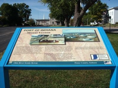
Port of Indiana
Mount Vernon
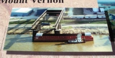
Located near the median center of the U. S. population, this port is only 152 miles from the confluence of the Ohio and Mississippi rivers. With more than 900 acres of land and many tenant companies, it offers advanced material handling, abundant specialized storage and room to grow with several industrial sites available.
The port provides 12 month barge access to the Gulf of Mexico and fleeting capacity for 450 barges as well as tug, towing, switching and dry-dock services. The port has six miles of rail track, dedicated locomotives for intraport switching, storage for 200 railcars and service by the Evansville Western Railway with potential interchange to five Class I railroads.
Mount Vernon is part of the Ports of Indiana three port system operating on Lake Michigan and the Ohio River. Indiana ranks 14th in the nation for waterborne shipping.
By the Way:
More than 50 percent of the Indiana border is water-based. This includes Lake Michigan and the Ohio and Wabash rivers.
Topics. This historical marker is listed in this topic list: Waterways & Vessels.
Location. 37° 55.895′ N, 87° 53.655′ W. Marker is in Mount Vernon, Indiana, in Posey County. Marker is at the intersection of East 3rd Street and Walnut Street, on the right when traveling west on East 3rd Street. Located on the South/East lawn corner of the Posey County Courthouse in Mount Vernon, Indiana. Touch for map. Marker is in this post office area: Mount Vernon IN 47620, United States of America. Touch for directions.
Other nearby markers. At least 8 other markers are within 14 miles of this marker, measured as the crow flies. Posey County History / Early Mt. Vernon History (within shouting distance of this marker); Mount Vernon's Historic Square (about 300 feet away, measured in a direct line); Posey County Soldiers and Sailors Memorial (about 300 feet away); Posey County American Revolution Honor Roll (about 300 feet away); Home of Alvin P. Hovey (about 300 feet away); Bettie Taylor Phillips (approx. 10.9 miles away in Kentucky); New Harmony Workingmen's Institute (approx. 13.8 miles away); Maclure Park Bandstand (approx. 13.9 miles away). Touch for a list and map of all markers in Mount Vernon.
Credits. This page was last revised on June 16, 2016. It was originally submitted on October 12, 2011, by Al Wolf of Veedersburg, Indiana. This page has been viewed 519 times since then and 16 times this year. Photos: 1, 2, 3, 4, 5. submitted on October 12, 2011, by Al Wolf of Veedersburg, Indiana. • Bill Pfingsten was the editor who published this page.


