
Emporia in Greensville County, Virginia — The American South (Mid-Atlantic)
Mecklenburg Electric Cooperative
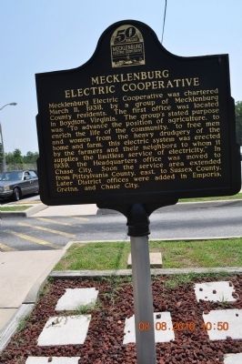
Photographed by Sandra Hughes, August 8, 2010
1. Mecklenburg Electric Cooperative Marker
Erected by Mecklenburg Electric Cooperative.
Topics and series. This historical marker is listed in these topic lists: Agriculture • Industry & Commerce. In addition, it is included in the Rural Electrification 💡 series list. A significant historical date for this entry is March 11, 1948.
Location. 36° 43.019′ N, 77° 34.784′ W. Marker is in Emporia, Virginia, in Greensville County. It is on Pleasant Shade Drive (U.S. 58) west of Carter Road (Virginia Route 649), on the right when traveling west. Touch for map. Marker is at or near this postal address: 1413 Pleasant Shade Drive, Emporia VA 23847, United States of America. Touch for directions.

Regionally, this marker is in Southside Virginia and specifically in Central Virginia. It is also in the American South and specifically in the Upper South. Globally, it is in North America, the Western Hemisphere, the Western World, and the Anglosphere. Historically, it finds itself in what was once the territory of the Mississippian Culture, one of the original Thirteen Colonies, one of the Confederate States of America, and the Antebellum South.
Other nearby markers. At least 8 other
this page online
Another marker is no longer nearby. Butts Tavern (was approx. 2.8 miles away but has been confirmed missing).
Also see . . . Mecklenburg Electric Cooperative. (Submitted on October 14, 2011, by Bernard Fisher of Richmond, Virginia.)
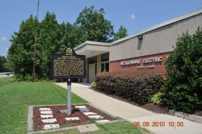
Photographed by Sandra Hughes, August 8, 2010
2. Mecklenburg Electric Cooperative Marker
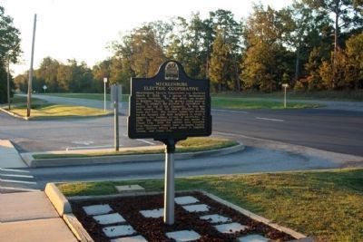
Photographed by Mike Stroud, October 13, 2012
3. Mecklenburg Electric Cooperative Marker along US 58
Credits. This page was last revised on August 3, 2017. It was originally submitted on October 14, 2011, by Sandra Hughes Tidwell of Killen, Alabama, USA. This page has been viewed 815 times since then and 40 times this year. Photos: 1, 2. submitted on October 14, 2011, by Sandra Hughes Tidwell of Killen, Alabama, USA. 3. submitted on October 21, 2012, by Mike Stroud of Bluffton, South Carolina. • Bernard Fisher was the editor who published this page.
