Near Louisa in Louisa County, Virginia — The American South (Mid-Atlantic)
Netherland Tavern
Hampton's Headquarters
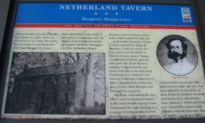
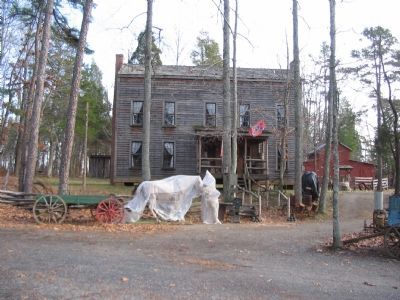
Fifty yards east is the site of Netherland Tavern (ca. 1822), which was demolished in the 1950s. The tavern served travelers on the Fredericksburg Stage Road and the Louisa Court House Road to the south. It also served rail passengers after the Virginia Central Railroad started operating in the 1850s. During the Civil War, Netherland Tavern became a center of military activity as the conflict entered its final year.
In June 1864, Union Gen. Ulysses S. Grant ordered Gen. Philip H. Sheridan to lead two cavalry divisions west from Cold Harbor in Hanover County, destroy Virginia Central Railroad track, unite his force with Gen. David Hunter's infantry at Charlottesville, and return with him to the main army. Confederate Gen. Robert E. Lee, learning of Sheridan's departure on June 7, dispatched divisions of Gens. Wade Hampton and Fitzhugh Lee in pursuit.
Hampton, commanding the expedition, made his headquarters here at the tavern on the evening of June 10 and spent the night sleeping on a carpenter's bench outside the front door. Sheridan, to the north, reached Clayton's Store (present-day Oakland) the same night, and only a few miles separated the two forces. At dawn on June 11, Hampton was awakened by two of his subordinates, Gens. Matthew C. Butler and Thomas L. Rosser. When Rosser asked Hampton what his plans were, Hampton replied, "I propose to fight."
Erected by Virginia Civil War Trails.
Topics and series. This historical marker is listed in this topic list: War, US Civil. In addition, it is included in the Virginia Civil War Trails series list. A significant historical month for this entry is June 1864.
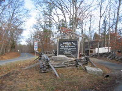
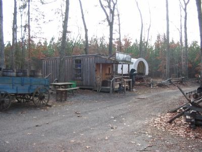
Location. 38° 3.1′ N, 78° 3.502′ W. Marker is near Louisa, Virginia, in Louisa County. Marker is on Oakland Road (County Route 613), on the right when traveling north. Located in front of the Netherland's Tavern and Civil War Museum, stop six on the driving tour of Trevilian Station Battlefield. Touch for map. Marker is in this post office area: Louisa VA 23093, United States of America. Touch for directions.
Other nearby markers. At least 8 other markers are within 3 miles of this marker, measured as the crow flies. Custer's First Last Stand (approx. 0.9 miles away); Custer Rescued (approx. 0.9 miles away); Trevilian Station Battle (approx. 0.9 miles away); Battle of Trevillians (approx. one mile away); Battle of Trevilians (approx. one mile away); Ogg Farm (approx. 2.2 miles away); Bibb's Crossroads (approx. 2˝ miles away); First Contact (approx. 3 miles away). Touch for a list and map of all markers in Louisa.
More about this marker. On the left side of the marker is a "post-war photograph of Netherland Tavern." On the right is a portrait
of Gen. Wade Hampton.
Regarding Netherland Tavern. This is one of several markers interpreting the Battle of Trevilian Station, June 11-12, 1864. See the Battle of Trevilian Station Virtual Tour by Markers linked below for additional related markers.
Also see . . . Trevilian Station Battlefield Foundation. The foundation has worked to preserve the remaining sections of the battlefield. A detailed self-guided driving tour of the battlefield is offered. This marker is at stop six of the tour. (Submitted on January 20, 2008, by Craig Swain of Leesburg, Virginia.)
Credits. This page was last revised on March 20, 2022. It was originally submitted on January 20, 2008, by Craig Swain of Leesburg, Virginia. This page has been viewed 3,306 times since then and 32 times this year. Photos: 1, 2, 3, 4. submitted on January 20, 2008, by Craig Swain of Leesburg, Virginia.


