Oakland near Louisa in Louisa County, Virginia — The American South (Mid-Atlantic)
Bibb's Crossroads
First Shots
| — | The Battle of Trevilian Station | — |
Photographed by Craig Swain, January 12, 2008
1. Bibb's Crossroads Marker
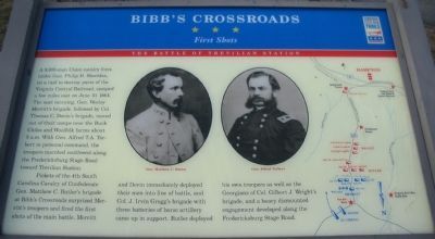
Pickets of the 4th South Carolina Cavalry of Confederate Gen. Matthew C. Butler's brigade at Bibb's Crossroads surprised Merritt's troopers and fired the first shots of the main battle. Merritt and Devin immediately deployed their men into line of battle, and Col. J. Irvin Gregg's brigade with three batteries of horse artillery came up in support. Butler deployed his own troopers as well as the Georgians of Col. Gilbert J. Wright's brigade, and a heavy dismounted engagement developed along the Fredericksburg Stage Road.
Erected by Virginia Civil War Trails.
Topics and series. This historical marker is listed in this topic list: War, US Civil.
this page online
Location. 38° 5.189′ N, 78° 2.906′ W. Marker is near Louisa, Virginia, in Louisa County. It is in Oakland. It is on Oakland Road (County Route 613), on the right when traveling north. Located at the Ebenezer United Methodist Church, stop four on the self guided driving tour of the battlefield. Touch for map. Marker is at or near this postal address: 3092 Oakland Road, Louisa VA 23093, United States of America. Touch for directions.

Regionally, this marker is in the Piedmont and in Central Virginia. It is also in the American South and specifically in the Upper South. Globally, it is in North America, the Western Hemisphere, the Western World, and the Anglosphere. Historically, it finds itself in what was once the territory of the Mississippian Culture, one of the original Thirteen Colonies, one of the Confederate States of America, and the Antebellum South.
Other nearby markers. At least 8 other markers are within 3 miles of this marker, measured as the crow flies: Netherland Tavern (approx. 2½ miles
Photographed by Craig Swain, January 12, 2008
2. Battle Map
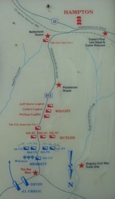
Note the north seeking arrow pointed to the bottom of the map. Also of note, the Poindexter Farm is still in private hands as of 2026 - some 20+ years after these markers were initially installed - and no Civil War Trails marker has been installed there as a result, despite it being marked as a stop on this map.
Other markers no longer nearby. Clayton's Store (was approx. 2.8 miles away but has been replaced with another marker now near it); Trevilian Station Battle (was approx. 2.8 miles away but has been confirmed missing).
More about this marker. The center of the marker features portraits of Gens. Matthew C. Butler and Alfred Torbert. On the right a map depicting the action at this phase of the battle, as described in the text.
Regarding Bibb's Crossroads. This is one of several markers interpreting the Battle of Trevilian Station, June 11-12, 1864. See the Battle of Trevilian Station Virtual Tour by Markers linked below for additional related markers.
Also see . . .
1. American Battlefield Trust - Trevilian Station. An authoritative source
Photographed by Evan Dwyer, June 11, 2026
3. Bibb's Crossroads Marker
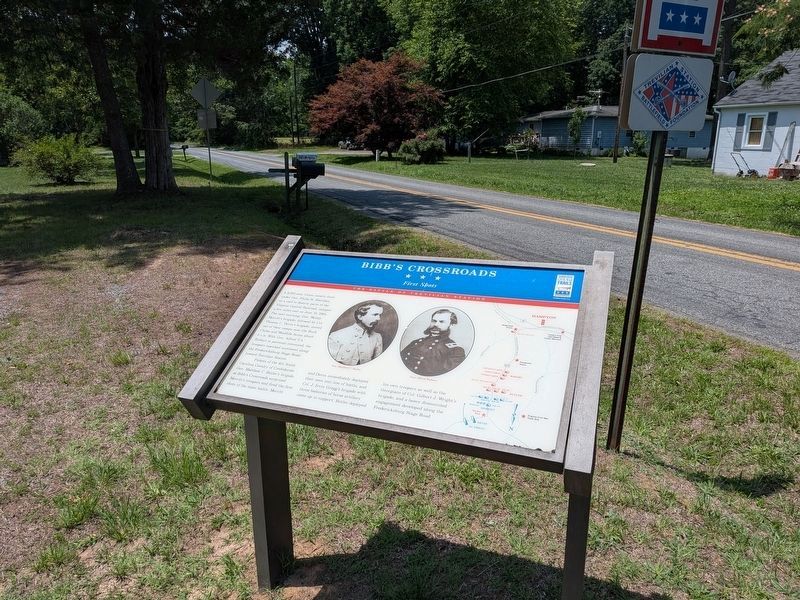
Context view, facing southwest. Note the original marker wore out and was replaced, but the text and images remain identical - the only change is a capitalized "A.M." instead of the lowercase version used in the original to describe timestamps.
2. Trevilian Station Battlefield Foundation. The foundation has worked to preserve the remaining sections of the battlefield. A detailed self-guided driving tour of the battlefield is offered. This marker is at stop four of the tour. (Submitted on January 20, 2008, by Craig Swain of Leesburg, Virginia.)
3. Battle of Trevilian Station Virtual Tour by Markers. A set of markers that document the Battle of Trevilian Station, June 11-12, 1864. The order of appearance is generally aligned to the Trevilian Station Battlefield Foundation driving tour, with accommodations made for convenience both in the town of Louisa at the beginning of the tour, and on the eastbound side of Route 33 headed back towards the cemetery. Because the C.G. Trevilian House at the 'modern' station does not have its own marker, reviewing this database for accompanying information when reading about the railroad tracks there is recommended for added interpretive value. (Submitted on August 15, 2026, by Evan Dwyer of Richmond, Virginia.)
Photographed by Craig Swain, January 12, 2008
4. Tour Stop Four - Ebenezer Methodist Church
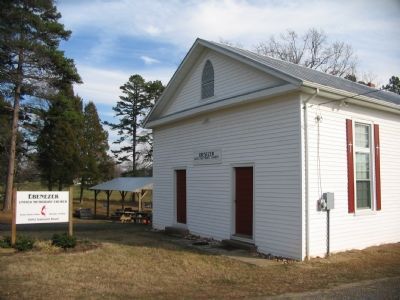
The church was not on this site at the time of the battle, but dates to the later part of the 19th century.
Photographed by Craig Swain, January 12, 2008
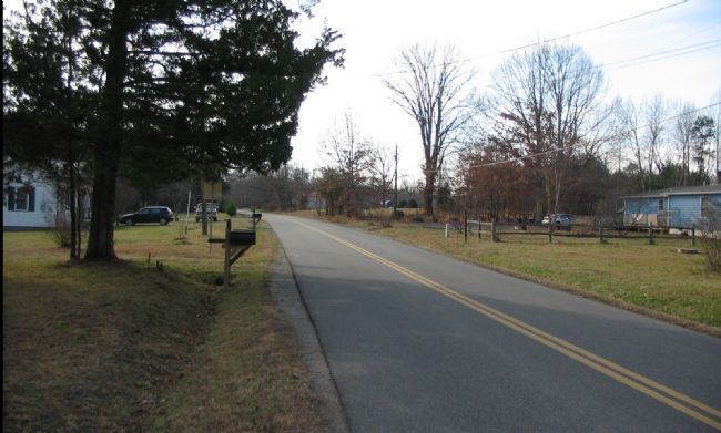
5. Old Fredericksburg Stage Road
Looking from the marker location to the south. Merritt's troopers, including some of the US Regulars cavalry and the 6th Pennsylvania, deployed astride the road here facing south to meet the Confederate cavalry.
Photographed by Craig Swain, January 12, 2008
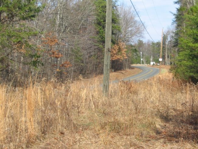
6. Tour Stop Five - Hampton's Charge
About two miles south along Oakland Road (Old Fredericksburg Stage Road) from the Bibb's Crossroads marker is the un-marked (presently) site of Hampton's Charge. This view is from the ground held by the Confederates on the morning of June 11. The heavy woods served to restrict movements, and the fighting was largely dismounted at many points.
Photographed by Craig Swain, January 12, 2008
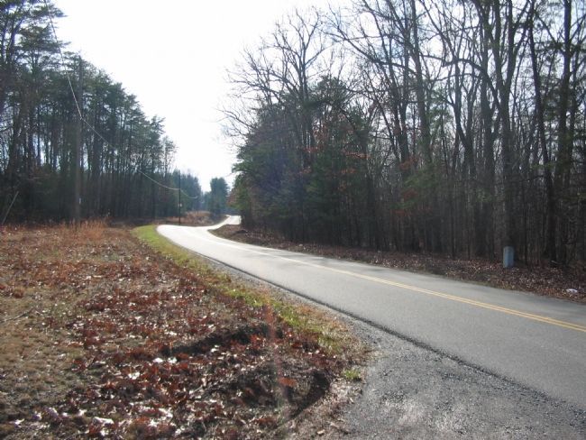
7. The Federal View of Hart's Battery
This view, from the Waylan Church parking lot, looking south along Oakland Road is directly opposite photo 5. Hart's Confederate Battery was deployed on the high ground in the distance. Their position was soon exposed to dismounted troopers from the 9th New York Cavalry. Seeing the emergency, General Wade Hampton personally led a detachment of the 6th South Carolina Cavalry into the fight. While this exposed the overall Confederate commander on the field to enemy fire, the charge saved Hart's guns.
Credits. This page was last revised on August 15, 2026. It was originally submitted on January 20, 2008, by Craig Swain of Leesburg, Virginia. This page has been viewed 2,471 times since then and 58 times this year. Photos: 1, 2. submitted on January 20, 2008, by Craig Swain of Leesburg, Virginia. 3. submitted on August 14, 2026, by Evan Dwyer of Richmond, Virginia. 4, 5. submitted on January 20, 2008, by Craig Swain of Leesburg, Virginia. 6, 7. submitted on January 21, 2008, by Craig Swain of Leesburg, Virginia.
