Hastings in Dakota County, Minnesota — The American Midwest (Upper Plains)
Enjoying the River
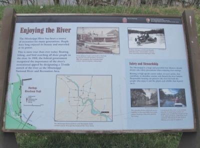
This is more true than ever today. Boating, hiking, and bird watching all draw people to the river. In 1988, the federal government recognized the importance of the river's recreational appeal by designating a 72-mile stretch of the river as the Mississippi River and Recreational Area.
Safety and Stewardship
The Mississippi is a large and powerful river. Boaters should always take safety precautions when enjoying river outings.
Boating at high speeds causes wakes, or wave action, that contribute to shoreline erosion and disturb the river habitat. Responsible boating can preserve the river for both the people who enjoy it and the plants and wildlife that depend on it.
Erected by City of Hastings; National Park Service, U.S. Department of the Interior, Mississippi National River and Recreation Area.
Topics and series. This historical marker is listed in this topic list: Waterways & Vessels. In addition, it is included in the Minnesota Historical Society series list. A significant historical year for this entry is 1988.
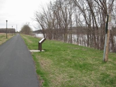
Location. 44° 45.002′ N, 92° 51.641′ W. Marker is in Hastings , Minnesota, in Dakota County. Marker can be reached from Lock and Dam Road, half a mile north of 2nd Street West, on the right when traveling north. Marker is along the Hastings Riverfront Trail. Touch for map. Marker is in this post office area: Hastings MN 55033, United States of America. Touch for directions.
Other nearby markers. At least 8 other markers are within walking distance of this marker. Living in the Water (about 700 feet away, measured in a direct line); Native Cultures (approx. 0.2 miles away); Going with the Flow (approx. 0.3 miles away); Downtown Develops (approx. half a mile away); American Legion Veterans Memorial (approx. 0.6 miles away); One Neighborhood, Many Stories (approx. 0.6 miles away); Spiral Bridge (approx. 0.6 miles away); Hastings, Minnesota (approx. 0.6 miles away). Touch for a list and map of all markers in Hastings.
More about this marker. [photo captions, clockwise from top]
• These pleasure boats were built in Hastings by the H.K. Stroud Company. Formed in 1885, the company also manufactured motors, marine engines, and pumps. City of Hastings
• Brothers George and Michael Mueller used this early "snowmobile" around Grey Cloud Island and Hastings in 1910. City of Hastings
• Canoeing on the river is increasingly popular. A surprising number of people even paddle the length of the river, approximately 2,300 miles from northern Minnesota to the Gulf of Mexico, as a way to explore it. National Park Service
• The growth of the outboard motor industry in the mid-1900s has made power boating a favorite pastime for many. Minnesota Historical Society
• The Mississippi National River and Recreation Area corridor passes through the heart of the Twin Cities.
Also see . . .
1. Mississippi National River and Recreation Area. U.S. National Park Service. (Submitted on October 19, 2011.)
2. Mississippi National River and Recreation Area. Wikipedia entry. (Submitted on October 19, 2011.)
Credits. This page was last revised on June 16, 2016. It was originally submitted on October 19, 2011, by Keith L of Wisconsin Rapids, Wisconsin. This page has been viewed 557 times since then and 5 times this year. Photos: 1, 2. submitted on October 19, 2011, by Keith L of Wisconsin Rapids, Wisconsin.

