Near Ludowici in Long County, Georgia — The American South (South Atlantic)
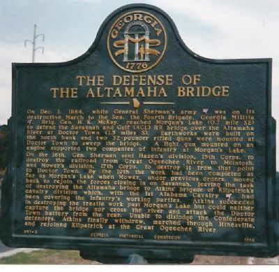
The Defense of the Altamaha Bridge
On the 16th Gen. Sherman sent Hazen's division, 13th Corps to destroy the railroad from Great Ogeechee River to McIntosh. and Mower's division, 17th Corps, to destroy it from that point to Doctor Town. By the 19th the work had been completed as far as Morgan's Lake when Mower, under previous orders, moved back to rejoin the forces closing in on Savannah, leaving the task of destroying the Altamaha bridge to Atkins' brigade of Kilpatrick's cavalry division which, with the 1st Alabama Cavalry, had been covering the infantry's working parties. Atkins succeeded in destroying the trestle work past Morgan's Lake but could neither capture the bridge nor cross the river and attack the Doctor Town battery from the rear. Unable to dislodge the Confederate defenders, Atkins finally withdrew, marched through Hinesville, and rejoined Kilpatrick at Great Ogeechee River.
Erected 1958 by Georgia Historical Commission. (Marker Number 091-6.)
Topics and series. This historical marker is listed in these topic lists: Bridges & Viaducts • War, US Civil. In addition, it is included in the Georgia Historical Society, and the Sherman’s March to the Sea series lists. A significant historical month for this entry is December 1862.
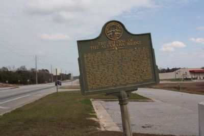
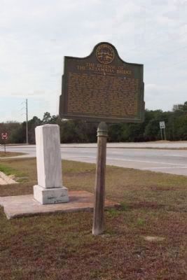
Location. 31° 40.702′ N, 81° 48.981′ W. Marker is near Ludowici, Georgia, in Long County. Marker is at the intersection of Savannah Highway (U.S. 25/301) and Fishing Road, on the right when traveling east on Savannah Highway. Located about a mile east of the bridge over the Altamaha River, just before the turn in to a quarry. Touch for map. Marker is in this post office area: Ludowici GA 31316, United States of America. Touch for directions.
Other nearby markers. At least 8 other markers are within 7 miles of this marker, measured as the crow flies. Franklinia Altamaha (a few steps from this marker); Doctortown (approx. 2.2 miles away); Historic Roads And Indian Trails (approx. 4.7 miles away); Long County Timeline Mural (approx. 4.8 miles away); Long County (approx. 4.9 miles away); Jones Creek Baptist Church (approx. 5˝ miles away); A Sesquicentennial Celebration (approx. 6.2 miles away); Wayne County Revolutionary War Memorial (approx. 6.3 miles away). Touch for a list and map of all markers in Ludowici.
Regarding The Defense of the Altamaha Bridge.
Fishing Road leads back to Morgan Lake, and the railroad bridge over that body of water. The Altamaha River bridge can only be reached from the south bank, taking Old Doctortown Road off US 25/84/301.
Related markers. Click here for a list of markers that are related to this marker. Federal activity in South Georgia after the fall of Savannah.
Also see . . . Battle of Altamah Bridge. Wikipedia article. (Submitted on January 20, 2008, by Craig Swain of Leesburg, Virginia.)
Additional commentary.
1. 32-pdr Cannon
At least one of the cannon used here at the Altamaha is still in South Georgia. When the threat to the bridge faded as Sherman's bummers opted to turn north into South Carolina, the defenses were soon neglected. As moving such a ponderous piece of metal would waste valuable resources, the guns were spiked and otherwise rendered useless. Some legends say a massive powder charge was loaded with double shot to deter, or at least surprise, any later use. At any rate, one of the 32-pdr cannon was later hauled by railroad to Waycross, Georgia, and now stands in front of the Confederate Memorial in that city.
— Submitted January 20, 2008, by Craig Swain of Leesburg, Virginia.

Photographed By Craig Swain, circa 1995
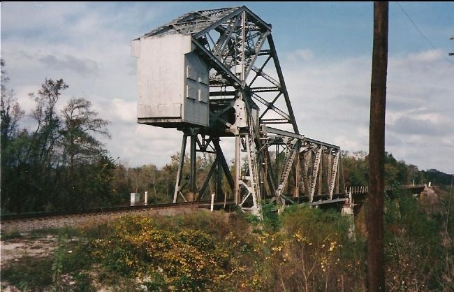
4. The Altamaha River Bridge at Doctor Town
The rifled 32-pounder cannon were in place along the high ground here next to the bridge. The bridge, while not the one in service at the time of the war, is along the same road bed and right of way. It is typical of bridges in coastal Georgia, in this case with a draw bridge section to allow masted vessels passage. Passage of such is of course is rather rare today. None of the Civil War related earthworks have survived the passage of time.
Credits. This page was last revised on June 16, 2016. It was originally submitted on January 20, 2008, by Craig Swain of Leesburg, Virginia. This page has been viewed 4,232 times since then and 52 times this year. Photos: 1. submitted on January 20, 2008, by Craig Swain of Leesburg, Virginia. 2, 3. submitted on January 6, 2009, by Mike Stroud of Bluffton, South Carolina. 4. submitted on January 20, 2008, by Craig Swain of Leesburg, Virginia.


