Near Jesup in Wayne County, Georgia — The American South (South Atlantic)
Doctortown
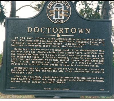
Doctortown was the major crossing point of the Altamaha River from the days when the Alachua Indian Path crossed there until WW II, when the Georgia Defense Forces and a Coast Guard Unit guarded the bridges against the threat of German sabotage. It was for many years the only road and railcrossing in this area of the coastal plain, thus making it a vital shipping and travel point. As a steamboat landing, Doctortown provided river access to important overland routes.
Doctortown was an important target for Gen. Sherman's troops on the March to the Sea and was the site of an unsuccessful assault in December, 1864.
After the Civil War, Doctortown became an industrial center for the South Georgia timber and paper industry as the site of large sawmills and the worlds largest pulp mill (1992).
Erected 1992 by Georgia Historical Commission. (Marker Number 151-2.)
Topics and series. This historical marker is listed in these topic lists: Industry & Commerce • Settlements & Settlers • War, US Civil • War, World II. In addition, it is included in the Georgia Historical Society series list. A significant historical month for this entry is December 1864.
Location. 31° 39.014′ N, 81° 49.957′ W. Marker is near Jesup, Georgia, in Wayne County. Marker is on Doctortown Road when traveling south. Located to the south of Savannah Highway (US 25/84/301). The location may now be on private property, but was documented accessible as late as 1998. Touch for map. Marker is in this post office area: Jesup GA 31545, United States of America. Touch for directions.
Other nearby markers. At least 8 other markers are within 7 miles of this marker, measured as the crow flies. The Defense of the Altamaha Bridge (approx. 2.2 miles away); Franklinia Altamaha (approx. 2.2 miles away); A Sesquicentennial Celebration (approx. 4.1 miles away); Wayne County Revolutionary War Memorial (approx. 4.2 miles away); Wayne County (approx. 4.2 miles away); Alexander Jackson Gordon (approx. 4.3 miles away); Long County Timeline Mural (approx. 6.6 miles away); Long County (approx. 6.7 miles away). Touch for a list and map of all markers in Jesup.
Additional commentary.
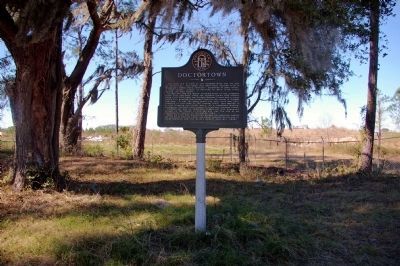
1. Access to Doctortown Marker
As of January, 2008 (and for
some time prior) the Doctortown marker is on the private property of the Rayonier Corporation, behind a locked gate. It is possible to gain access to the marker by contacting the Security Department at the Rayonier Mill (number is on the gate).
The stated reason for the lack of public access is to keep the public from an unguarded railroad crossing just beyond the marker.
— Submitted April 15, 2008, by David Seibert of Sandy Springs, Georgia.

Photographed By Craig Swain
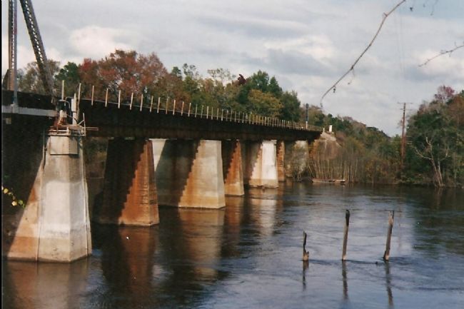
3. River Side View of the Altamaha River Bridge
The threat of sabotage was indeed real during the early days of World War II. German U-Boats were active off the coast of Georgia, particularly around Brunswick, a major coastal convoy port. The Altamaha River delta is a maze of channels and passages, and the fear was a raiding party could well sneak through to the railroad bridge. The area downstream from the bridge was, and still is, largely swamp and marsh. Even to this day, only the Interstate 95 and Coastal Highway 17 bridges cross the Altamaha downstream from this point.
The wooden poles on the lower right are part of a submerged structure. In lower water, the structure appears to be either an old wharf or sunken barge.
The wooden poles on the lower right are part of a submerged structure. In lower water, the structure appears to be either an old wharf or sunken barge.

Photographed By Craig Swain
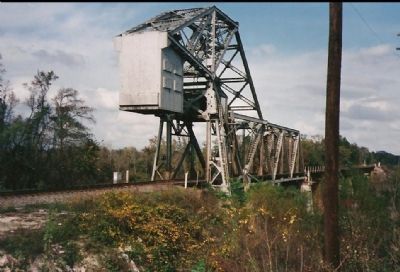
4. The Altamaha River Bridge at Doctor Town
The rifled 32-pounder cannon were in place along the high ground here next to the bridge. The bridge, while not the one in service at the time of the war, is along the same road bed and right of way. It is typical of bridges in coastal Georgia, in this case with a draw bridge section to allow masted vessels passage. Passage of such is of course is rather rare today. None of the Civil War related earthworks have survived the passage of time.
Credits. This page was last revised on June 16, 2016. It was originally submitted on January 20, 2008, by Craig Swain of Leesburg, Virginia. This page has been viewed 4,649 times since then and 61 times this year. Photos: 1. submitted on January 20, 2008, by Craig Swain of Leesburg, Virginia. 2. submitted on April 15, 2008, by David Seibert of Sandy Springs, Georgia. 3, 4. submitted on January 20, 2008, by Craig Swain of Leesburg, Virginia.

