Niagara-on-the-Lake in Niagara Region, Ontario — Central Canada (North America)
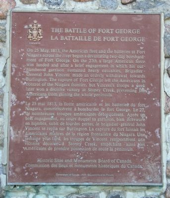
The Battle of Fort George
La Bataille de Fort George
Photographed by Dale K. Benington, July 27, 2011
1. The Battle of Fort George Marker
Le 25 mai 1813, la flotte américaine et les batteries du fort Niagara, commencèrent à bombarder le fort George. Le 27, de nombreuses troupes américaines débarquèrent. Après un bref engagement, au cours duquel sa garnison, bien inférieure en nombre, subit de lourdes pertes, le brigadier-général John Vincent se replia sur Burlington. La capture du fort laissait les Américaines maîtres de la région frontalière du Niagara. Une semaine plus tard, les troupes de Vincent remportèrent une victoire décisive à Stoney Creek, empêchant ainsi les Américains de prendre
this page online
Erected by Historic Sites and Monuments Board of Canada.
Topics and series. This historical marker is listed in this topic list: War of 1812. In addition, it is included in the Canada, Historic Sites and Monuments Board series list. A significant historical date for this entry is May 25, 1813.
Location. 43° 15.717′ N, 79° 5.086′ W. Marker is in Niagara-on-the-Lake, Ontario, in Niagara Region. It is on Queen Street north of Newark Street, on the right when traveling north. This historical marker is located on the Canadian side of the mouth of the Niagara River, where the river empties into Lake Ontario. It is situated on the northwestern edge of the Niagara-on-the-Lake Golf Course. Touch for map. Marker is at or near this postal address: 454 Queen Street, Niagara-on-the-Lake ON L0S 1J0, Canada. Touch for directions.

Regionally, this marker is on the Golden Horseshoe and in Niagara Canada. It is also in Central Canada. Globally, it is in North America, on the Great Lakes, in the Western Hemisphere, in the Western World, and in the Anglosphere. Historically, it finds itself in what was once
Photographed by Dale K. Benington, July 27, 2011
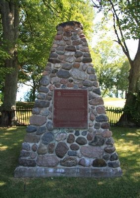
2. The Battle of Fort George Marker
Other nearby markers. At least 8 other markers are within walking distance of this marker: The Remains of Three Soldiers (here, next to this marker); Fort Mississauga is a National Historic Site (approx. 0.6 kilometers away); Landsdowne Pond Wetland Biodiversity Enhancement Project (approx. 0.6 kilometers away); A Fort Evolves (approx. 0.7 kilometers away); A Strategic Location (approx. 0.7 kilometers away); Richardson-Kiely House circa 1832 (approx. 0.7 kilometers away); Chautauqua Park (approx. 0.8 kilometers away); Fort Mississauga Trail (approx. 0.8 kilometers away). Touch for a list and map of all markers in Niagara-on-the-Lake.
Other markers no longer nearby. Point Mississauga Lighthouse (was approx. 0.6 kilometers away but has been confirmed missing); Fort Mississauga (was approx. 0.6 kilometers away but has been confirmed missing).
Related markers. Click here for a list of markers that are related to this marker. To better understand the relationship, study each marker in the order shown.
Also see . . .
1. Battle of Fort George.
Photographed by Dale K. Benington, July 27, 2011
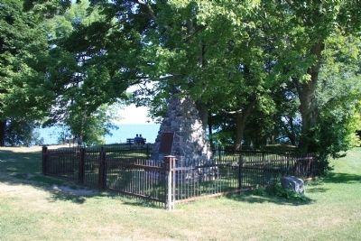
3. The Battle of Fort George Marker
View of the historical marker, enclosed by a fence, with Lake Ontario in the background.
2. Battle of Fort George, 25-27 May 1813. This is a link to a War of 1812 web site. (Submitted on November 11, 2011, by Dale K. Benington of Toledo, Ohio.)
Photographed by Dale K. Benington, July 27, 2011
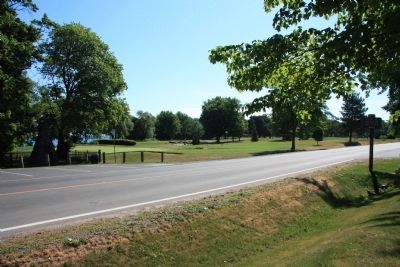
4. The Battle of Fort George Marker
View of the historical marker in the left corner of the picture, looking south along Queen Street, with the Niagara-on-the-Lake Golf Course in the background.
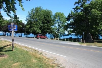
Photographed by Dale K. Benington, July 27, 2011
5. The Battle of Fort George Marker
View of the historical marker in the right corner of the picture (under the nearby tree), looking north along Queen Street, with Lake Ontario in the background.
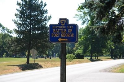
Photographed by Dale K. Benington, July 27, 2011
6. The Battle of Fort George Marker
View of the directional marker, located across the street from the historical marker.
Credits. This page was last revised on February 16, 2026. It was originally submitted on October 22, 2011, by Dale K. Benington of Toledo, Ohio. This page has been viewed 1,079 times since then and 45 times this year. Photos: 1, 2, 3, 4, 5, 6. submitted on October 24, 2011, by Dale K. Benington of Toledo, Ohio.
