Lincoln Park in San Francisco City and County, California — The American West (Pacific Coastal)
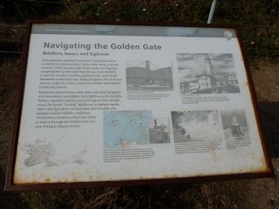
Navigating the Golden Gate - Bonfires, buoys, and foghorns
Inscription.
Deep channels make San Francisco’s remarkable harbor accessible to immense ships. On the other hand, a narrow entrance, swift currents, high winds, rocks, and fog make navigating the Golden Gate treacherous. Early mariners looked for on-shore bonfires, painted rocks, and natural landmarks to find their way. Today, navigators rely on buoys, beacons, foghorns, charts, sonar, and satellite-based global positioning systems.
Distinctive characteristics make some individual navigation aids immediately identifiable. Each lighthouse, for example, flashes a signature pattern, and each foghorn has a unique sound. By simply “reading” lighthouse or foghorn signals, sailors and ship pilots can determine their location and navigate in poor visibility conditions. Nonetheless, numerous ships have failed to make it through the Golden Gate and now belong to shipwreck lore.
Photo captions:
Troopship entering Golden Gate, 1951
Traffic in, out, and around the bay is coordinated by the U.S. Coast Guard’s Vessel Traffic Service. The Coast Guard also maintains the bays buoys, lights, and foghorns. San Francisco Maritime Museum
Alcatraz lighthouse, c. 1945
The oldest beacon on the West Coast is still in operation on Alcatraz. First lit in 1854, when Gold Rush fortune seekers were flooding through the Golden Gate, the light was moved into a taller lighthouse in 1909 and automated in 1963. United States Coast Guard
Nautical charts provide information you’ll never see on a road map, including water depths, the locations of potential hazards, and the identifying frequencies – or signatures – of foghorns. This simplified chart has been overlaid with symbols representing the various navigation aids in operation around the entrance to San Francisco harbor. San Francisco Maritime Museum
This whitewashed patch of cliff once served as a navigation aid to ships entering the Golden Gate strait. Pilots knew they were safely within the shipping lane if “Painted Rock” at Lands End was aligned with Mile Rock lighthouse. This marker is still visible along the trail a short walk east of here.
John Martini
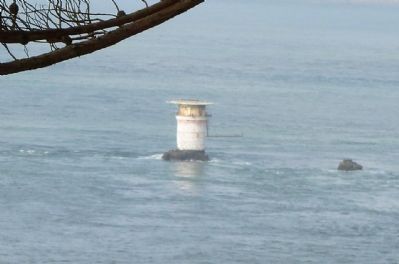
Mile Rock lighthouse, constructed in 1906, was converted to a helicopter landing pad with an automated light in 1966. James Watson, San Francisco Maritime Museum
Erected by Golden Gate National Recreation Area, National Park Service.
Topics and series. This historical marker is listed in these topic lists: Communications • Waterways & Vessels. In addition, it is included in the Lighthouses series list. A significant historical year for this entry is 1951.
Location.
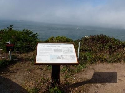
This marker has been replaced by another marker nearby. It was located near 37° 47.006′ N, 122° 30.666′ W. Marker was in San Francisco, California, in San Francisco City and County. It was in Lincoln Park. Marker was on Lands End Trail west of El Camino del Mar. Touch for map. Marker was in this post office area: San Francisco CA 94121, United States of America. Touch for directions.
Other nearby markers. At least 8 other markers are within walking distance of this location. Navigating the Golden Gate (a few steps from this marker); The Golden Gate (within shouting distance of this marker); Port of San Francisco (within shouting distance of this marker); Lands End (within shouting distance of this marker); Death of a Sailor (within shouting distance of this marker); The Honored Dead (within shouting distance of this marker); This Memorial to Rear Admiral Daniel J. Callaghan (within shouting distance of this marker); FDR's Salute (within shouting distance of this marker). Touch for a list and map of all markers in San Francisco.
Credits. This page was last revised on February 7, 2023. It was originally submitted on October 23, 2011, by Richard E. Miller of Oxon Hill, Maryland. This page has been viewed 1,799 times since then and 17 times this year. Photos: 1, 2, 3. submitted on October 23, 2011, by Richard E. Miller of Oxon Hill, Maryland. • Syd Whittle was the editor who published this page.


