Wenham in Essex County, Massachusetts — The American Northeast (New England)
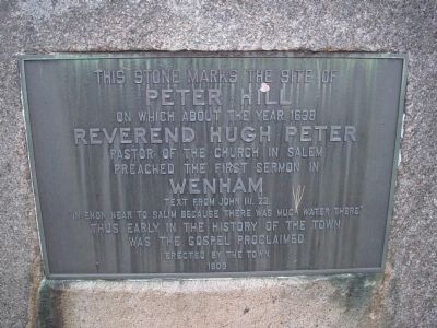
This Stone Marks the Site of Peter Hill
Peter Hill
on which about the year 1638
Reverend Hugh Peter
Pastor of the church in Salem
preached the first sermon in
Wenham
Text from John III.23
"In enon near to Salim because there was much water there."
Thus early in the history of the town
was the gospel proclaimed.
Erected 1908 by "The Town" [of Wenham].
Topics. This historical marker is listed in these topic lists: Churches & Religion • Colonial Era • Settlements & Settlers. A significant historical year for this entry is 1638.
Location. 42° 35.722′ N, 70° 53.21′ W. Marker is in Wenham, Massachusetts, in Essex County. Marker is on Main Street (State Highway 1A), on the right when traveling west. Touch for map. Marker is in this post office area: Wenham MA 01984, United States of America. Touch for directions.
Other nearby markers. At least 8 other markers are within 3 miles of this marker, measured as the crow flies. Wenham Lake (approx. ¼ mile away); Wenham (approx. 0.6 miles away); Site of Camp Lander (approx. one mile away); a different marker also named Wenham (approx. one mile away); Conant House (approx. 1.4 miles away); Roger Conant (approx. 2.1 miles away); Planters Path to their Landing Place (approx. 2.2 miles away); Balch House (approx. 2.3 miles away). Touch for a list and map of all markers in Wenham.
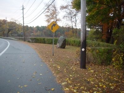
More about this marker. The coloring of the marker makes it hard (while approaching) to recognize the marker on the stone however it is in a well maintained area. There is a golf course across the road.
This is a busy roadway, common sense and caution should be used. It is marked as a "No stopping" area.
Related markers. Click here for a list of markers that are related to this marker. To better understand the relationship, study each marker in the order shown.
Credits. This page was last revised on June 16, 2016. It was originally submitted on November 2, 2010, by Michael Tiernan of Danvers, Massachusetts. This page has been viewed 871 times since then and 32 times this year. Last updated on October 25, 2011, by Michael Tiernan of Danvers, Massachusetts. Photos: 1, 2. submitted on November 2, 2010, by Michael Tiernan of Danvers, Massachusetts. • Bill Pfingsten was the editor who published this page.

