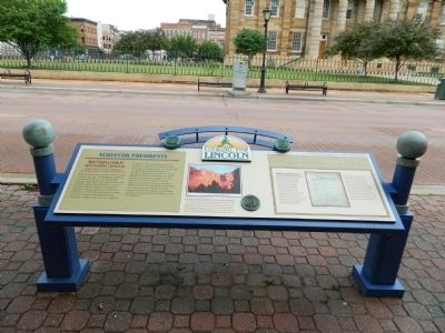
Surveyor Presidents
Looking for Lincoln
Many people look at Mount Rushmore, carved in the Black Hills of South Dakota, as a monument to four Presidents, but land surveyors see it as "three surveyors and one other guy." Washington, Jefferson, and Lincoln all were land surveyors. George Washington was sixteen years old when he went with Joshua Fry to survey the great Fairfax Grant in Northwest Virginia. Thomas Jefferson followed in his father's footsteps and became a land surveyor. He was appointed County Surveyor of Albemarle County, Virginia.
In May of 1784, Jefferson presented the Public Land Survey System to the Continental Congress as a way to describe the lands known as the Northwest Territory. This system is still used today. Abraham Lincoln, while living in New Salem, was appointed Deputy County Surveyor in 1833 by John Calhoun, Sangamon County Surveyor. Between 1833 and 1837 Lincoln performed about thirty farm surveys and several road surveys. Lincoln also laid out the towns of Albany, Bath, Huron, Petersburg, and New Boston.
In 1832, while living in New Salem, Lincoln ran for the office of Illinois State Representative but was defeated. In 1834, however, after becoming known as a trusted and fair land surveyor, he ran again and won. Lincoln's background in land surveying also proved to be valuable during his legal career. In 1839, Lincoln
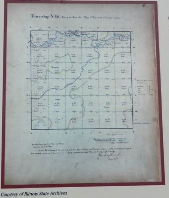
used his knowledge of surveying when he was called on by the Court to survey a disputed section of land in Sangamon County. His professional survey ended the dispute.Thomas Jefferson devised a way to divide the land of the Northwest Territory into rectangular sections, making it easier to sell to the early settlers. Government Surveyors started laying out the sections in 1804. They sent their survey notes to St. Louis where the Township Plats were drawn. The plats were then sent to the Government Land Offices where settlers would view them before purchasing their land. Early Illinois settlers could visit the Government Land Office in Springfield, which was opened in 1822. Eleven years later, in 1833, young Abraham Lincoln visited the Land Office to learn where the original surveying monuments were set. Walter Davis, who Congressman Lincoln would later endorse as land receiver, kept his office on the second floor of a building here on the north side of the public square.
Erected by State of Illinois Historic Preservation Agency & Looking for Lincoln Heritage Coalition.
Topics and series. This historical marker is listed in these topic lists: Government & Politics • Industry & Commerce • Parks & Recreational Areas
Location. 39° 48.11′ N, 89° 38.902′ W. Marker is in Springfield, Illinois, in Sangamon County. Marker is on Washington Street just west of 6th Street. Touch for map. Marker is in this post office area: Springfield IL 62701, United States of America. Touch for directions.
Other nearby markers. At least 8 other markers are within walking distance of this marker. Streetscape 1859 (within shouting distance of this marker); Stuart and Lincoln Law Office (about 300 feet away, measured in a direct line); The Wedding of the Rose and the Lotus (about 300 feet away); Lincoln's Last Law Office (about 300 feet away); Cook's Hall (about 400 feet away); Corneau & Diller Drug Store (about 400 feet away); Barack Obama Campaign Announcements (about 400 feet away); Old State Capitol (about 400 feet away). Touch for a list and map of all markers in Springfield.
Credits. This page was last revised on November 17, 2019. It was originally submitted on October 25, 2011, by Bill Pfingsten of Bel Air, Maryland. This page has been viewed 781 times since then and 29 times this year. Photos: 1, 2. submitted on October 25, 2011, by Bill Pfingsten of Bel Air, Maryland.

