Near Triangle in Prince William County, Virginia — The American South (Mid-Atlantic)
Road to Yorktown
The King’s Highway
Photographed by Kevin W., January 21, 2008
1. The Kings Highway ~ Road to Yorktown Marker
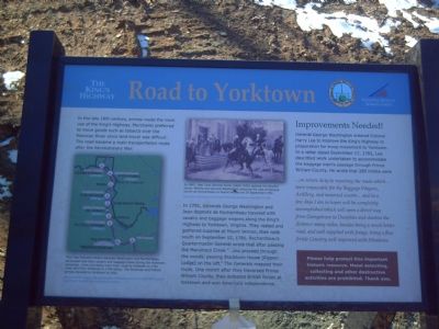
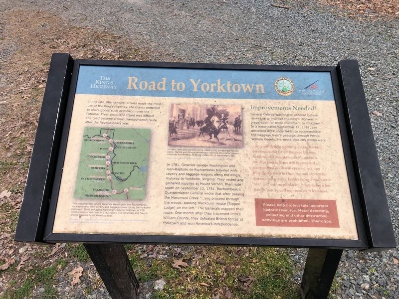
In the late 18th century, armies made the most use of the King’s Highway. Merchants preferred to move goods such as tobacco over the Potomac River since land travel was difficult. The road became a main transportation route after the Revolutionary War.
In 1781, Generals George Washington and Jean-Baptiste de Rochambeau traveled with cavalry and baggage wagons along the King’s Highway to Yorktown, Virginia. They rested and gathered supplies at Mount Vernon, then rode south on September 12, 1781. Rochambeau’s Quartermaster General wrote that after passing the Marumsco Creek “…you proceed through the woods, passing Blackburn House [Rippon Lodge] on the left.” The Generals mapped their route. One month after they traversed Prince William County, they defeated British forces at Yorktown and won America’s independence.
Improvements Needed!
General George Washington ordered Colonel Harry Lee to improve the King’s Highway in preparation for troop movement to Yorktown. In a letter dated September 17, 1781, Lee described work undertaken to accommodate the baggage train’s passage through Prince William County.
this page online
…on severe duty in repairing the roads which were impassable for the Baggage Wagons, Artillery, and mounted escorts…and in a few days I am in hopes will be completely accomplished which will open a direct way from Georgetown to Dumfries and shorten the distance many miles, besides being a much better road, and well supplied with forage, being a fine fertile Country well improved with Meadows.
Erected 2007 by the National Museum of the Marine Corps and Prince William County.
Topics and series. This historical marker is listed in these topic lists: Military • Roads & Vehicles • War, US Revolutionary. In addition, it is included in the Former U.S. Presidents: #01 George Washington, and the The Washington-Rochambeau Route series lists. A significant historical month for this entry is September 1730.
Location. 38° 32.777′ N, 77° 20.505′ W. Marker is near Triangle, Virginia, in Prince William County. It can be reached from Richmond Highway (U.S. 1). Marker is located on the grounds of the National Museum of the Marine Corps, near the playground. Touch for map. Marker is at or near this postal address: 18900
Photographed by Devry Becker Jones (CC0), March 12, 2021
2. Road to Yorktown Marker
The marker is showing its age over 13 plus years.

Regionally, this marker is in the Washington Metropolitan Area, in Northern Virginia, and in the Piedmont. It is also in the American South, specifically in the Upper South, in the Mid-Atlantic, and on the Eastern Seaboard. Globally, it is in the North Atlantic Region, North America, the Western Hemisphere, the Western World, and the Anglosphere. Historically, it finds itself in what was once the territory of the Mississippian Culture, one of the original Thirteen Colonies, one of the Confederate States of America, and the Antebellum South.
Other nearby markers. At least 8 other markers are within walking distance of this marker: The Return from Yorktown (about 400 feet away); TBS Class 4-69 KIA (about 600 feet away); 22nd Marines WWII (about 600 feet away); LtCol Lew Dement USMC (about 600 feet away); In Memoriam (about 700 feet away); Col John R. Bates (about 700 feet away); Col Wally Campbell (about 700 feet away); Iron Mike (about 700 feet away). Touch for a list and map of all markers in Triangle.
Another marker is no
Photographed by Kevin W., January 21, 2008
3. The Kings Highway ~ Road to Yorktown Marker
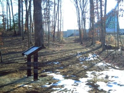
The King's Highway between this marker and the National Museum of the Marine Corps (in the background) has been improved through the laying of fresh mulch.
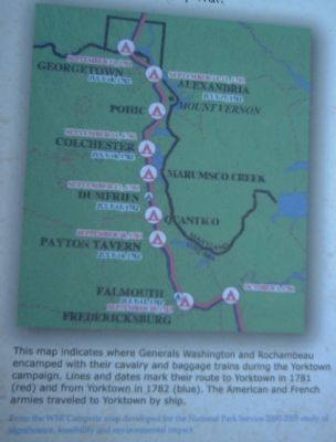
More about this marker. On the lower left is a map detailing the route Generals Washington and Rochambeau traveled to their victory at Yorktown. The map carries the caption, "This map indicates where Generals Washington and Rochambeau encamped with their cavalry and baggage trains during the Yorktown campaign. Lines and dates mark their route to Yorktown in 1781 (red) and from Yorktown in 1782 (blue). The American and French armies traveled to Yorktown by ship." The marker identifies the source as ...the W3R Campsite map developed for the national Park Service 2000-2005 study of significance, feasibility and environmental impact.
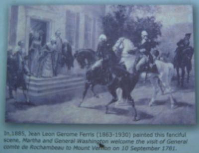
In the upper center the marker displays a 1885 painting by Jean Leon Gerome Ferris (1863-1890), described as a "...fanciful scene, Martha and General Washington welcome the visit of General comte de Rochambeau to Mount Vernon on 10 September 1781." The marker identifies the source of this picture as, "George Washington by Herman S. Frey, Frey Enterprises, Nashville,
Photographed by Kevin W., January 21, 2008
4. The Kings Highway ~ Road to Yorktown Marker
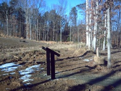
This area of the King's Highway remains virtually untouched from its days as the main road way through this area of Virginia.
Also see . . . Virtual Tour of The King's Highway. (Submitted on January 22, 2008, by Kevin W. of Stafford, Virginia.)
Photographed by Kevin W., January 21, 2008
5. Closeup of the map in the lower left.
The map details the route Generals Washington and Rochambeau, with their cavalry and baggage trains, traveled to their victory at Yorktown.
Photographed by Kevin W., January 21, 2008
6. Closeup of the 1885 painting by Jean Leon Gerome Ferris
Credits. This page was last revised on January 6, 2025. It was originally submitted on January 22, 2008, by Kevin W. of Stafford, Virginia. This page has been viewed 2,000 times since then and 33 times this year. Photos: 1. submitted on January 22, 2008, by Kevin W. of Stafford, Virginia. 2. submitted on March 12, 2021, by Devry Becker Jones of Washington, District of Columbia. 3, 4, 5, 6. submitted on January 22, 2008, by Kevin W. of Stafford, Virginia.
