Newport in Newport County, Rhode Island — The American Northeast (New England)
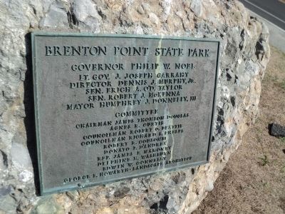
Brenton Point State Park
Photographed by Bill Coughlin, October 8, 2011
1. Brenton Point State Park Marker
Lt. Governor J. Joseph Garrahy
Director Dennis J. Murphy, Jr.
Sen. Erich A. O’D. Taylor, President
Sen. Robert J. McKenna
Mayor Humphrey J. Donnelly, III
Committee
Chairman James Thomson Douglas
Agnes R. Curtis
Councilman Robert O. Beattie
Councilman Richard S. Phelps
Robert R. Coulombe
Donato F. D’Andrea
Rep. James F. Mahoney
Delphine H. Washburn
Edwin W. Connelly
George F. Howarth – Landscape Architect
Topics. This historical marker is listed in these topic lists: Architecture • Parks & Recreational Areas.
Location. 41° 27.019′ N, 71° 21.177′ W. Marker is in Newport, Rhode Island, in Newport County. It is on Ocean Drive, on the left when traveling south. Marker is located in Brenton Point State Park. Touch for map. Marker is in this post office area: Newport RI 02840, United States of America. Touch for directions.

Regionally, this marker is on Narragansett Bay and in Newport and Aquidneck Island. It is also in the American Northeast, in New England, and on the Eastern Seaboard. Globally, it is in the North Atlantic Region, North America, the Western
this page online
Other nearby markers. At least 8 other markers are within walking distance of this marker: The Rocky Shore (about 300 feet away, measured in a direct line); EgyptAir Flight 990 Memorial (about 500 feet away); S/V Marques (about 500 feet away); RI Pilots of Brenton Reef Pilot Station (about 500 feet away); Brenton Point Maritime Memorial (about 500 feet away); Portuguese Navigators Monument (about 600 feet away); Portuguese Navigators: Pioneers in Maritime Exploration (about 600 feet away); Missing at Sea May 7, 2007 (approx. 0.2 miles away). Touch for a list and map of all markers in Newport.
Additional keywords. landscape architecture
Photographed by Bill Coughlin, October 8, 2011
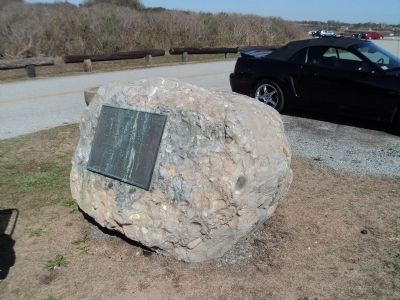
2. Brenton Point State Park Marker
Photographed by Bill Coughlin, October 8, 2011
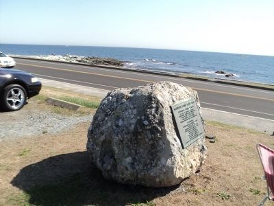
3. Marker on Ocean Drive
Credits. This page was last revised on May 8, 2023. It was originally submitted on October 30, 2011, by Bill Coughlin of Woodland Park, New Jersey. This page has been viewed 980 times since then and 44 times this year. Photos: 1, 2, 3. submitted on October 30, 2011, by Bill Coughlin of Woodland Park, New Jersey.
