Champlain in Clinton County, New York — The American Northeast (Mid-Atlantic)
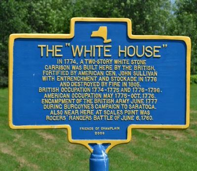
The "White House"
garrison was built here by the British,
fortified by American Gen. John Sullivan
with entrenchment and stockade in 1776
and destroyed by fire in 1805.
British occupation 1774 - 1775 and 1776-1796.
American occupation May 1775 - Oct. 1776.
Encampment of the British Army June 1777
during Burgoyne's Campaign to Saratoga.
Also near here at Scales Point was
Rogers' Rangers Battle of June 6, 1760.
Erected 2009 by Friends of Champlain.
Topics. This historical marker is listed in these topic lists: Forts and Castles • War, French and Indian • War, US Revolutionary. A significant historical year for this entry is 1774.
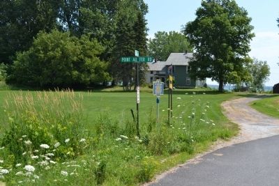
Location. 44° 56.715′ N, 73° 21.167′ W. Marker is in Champlain, New York, in Clinton County. Marker is on Point Au Fer Road. Touch for map. Marker is in this post office area: Champlain NY 12919, United States of America. Touch for directions.
Other nearby markers. At least 8 other markers are within 4 miles of this marker, measured as the crow flies. Point au Fer Historic Site (about 400 feet away, measured in a direct line); Site of Joel Smith's Home (approx. 2.2 miles away); Ezra Thurber’s Home (approx. 2.4 miles away); David Mayo's Sail Ferry (approx. 2.7 miles away); Site of First School House (approx. 2.7 miles away); Samuel de Champlain Monument (approx. 3.1 miles away in Vermont); Site of French Fort Ste. Anne (approx. 3.1 miles away in Vermont); A Place Of Pilgrimage (approx. 3.1 miles away in Vermont).
Credits. This page was last revised on June 16, 2016. It was originally submitted on November 2, 2011, by Joe Harness of Little Egg Harbor, New Jersey. This page has been viewed 939 times since then and 31 times this year. Photos: 1, 2. submitted on November 2, 2011, by Joe Harness of Little Egg Harbor, New Jersey. • Bill Pfingsten was the editor who published this page.

