Mentor in Lake County, Ohio — The American Midwest (Great Lakes)
Marsh Settlement
Photographed by William Fischer, Jr., June 9, 2011
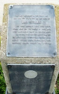
1. Marsh Settlement Marker
The first settlement in this county was made near this site in 1797 and was known as Marsh Settlement. The early residents were: Jesse Phelps, Hosmer Merry and the families of Jared Ward, Moses Parks, Charles Parker and Ebenezer Merry.
For several years Ebenezer Merry's cabin was the voting place for Painesville Township which included Kirtland, Mentor, Concord, Leroy, Perry, Painesville, Chardon, Hambden and Mountville.
Erected by Lake County Historical Society.
Topics. This historical marker is listed in these topic lists: Environment • Settlements & Settlers. A significant historical year for this entry is 1797.
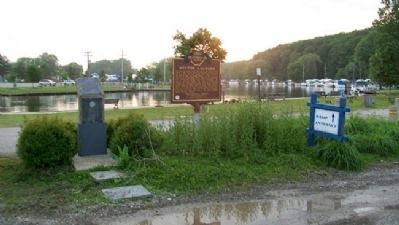
Location. 41° 43.545′ N, 81° 20.332′ W. Marker is in Mentor, Ohio, in Lake County. It can be reached from Harbor Drive. Marker is near the entrance to the Mentor Lagoons Nature Preserve and Marina. Touch for map. Marker is at or near this postal address: 8365 Harbor Drive, Mentor OH 44060, United States of America. Touch for directions.

Regionally, this marker is in Greater Cleveland, on the Lake Erie Shore, and in the Western Reserve. It is also in the American Midwest. Globally, it is in North America, on the Great Lakes, in the Western Hemisphere, in the Western World, and in the Anglosphere. Historically, it finds itself in what was once the Haudenosaunee (Iroquois) Confederacy, the territory of the Mississippian Culture, and the Northwest Territory.
Other nearby markers. At least 8 other markers are within walking distance of this marker: Mentor Lagoons (here, next to this marker); Mentor Lagoons Nature Preserve (within shouting distance of this marker); a different marker also named Mentor Lagoons Nature Preserve (about 300 feet away, measured in a direct line); Mentor Marsh (about 400 feet away); Restoring the Marsh (about 600 feet away); When Disaster Strikes (about
this page online
Another marker is no longer nearby. Mentor Lagoons Water Trail (was here, next to this marker but has been permanently removed).
Also see . . . Mentor Timeline. (Submitted on November 4, 2011, by William Fischer, Jr. of Reynoldsburg, Ohio.)
Photographed by William Fischer, Jr., June 9, 2011
2. Marsh Settlement Marker
Credits. This page was last revised on June 16, 2016. It was originally submitted on November 4, 2011, by William Fischer, Jr. of Reynoldsburg, Ohio. This page has been viewed 1,018 times since then and 70 times this year. Photos: 1, 2. submitted on November 4, 2011, by William Fischer, Jr. of Reynoldsburg, Ohio.
