Port Bolivar in Galveston County, Texas — The American South (West South Central)
Port Bolivar

Photographed By Richard Denney, November 5, 2011
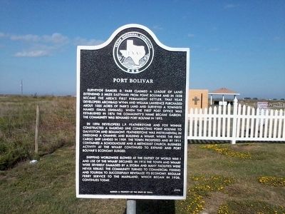
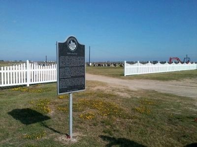
1. Port Bolivar Marker
While this marker indicates it was first erected in 1995, this one appears to be new and may be a replacement for one lost (either at this location or some other location) in Hurricane Ike in 2008 which devastated much of Bolivar peninsula.
In 1896 developers L.P. Featherstone and Fox Winnie constructed a railroad line connection Point Bolivar to Galveston and Beaumont. Featherstone was instrumental in dredging a channel and building a wharf, where the first cargo ship landed in 1909. The town prospered and by 1911 contained a schoolhouse and a Methodist church. Business activity at the wharf continued to expand and Port Bolivar's economy surged.
Shipping worldwide slowed at the outset of World War I and use of the wharf declined. In 1915 the town and wharf were severely damaged by a storm and many facilities were never rebuilt. The community turned to commercial fishing and tourism to successfully revitalize its economy. Regular ferry service to the mainland, which began in 1930, continues today.
Erected 1995 by Texas Historical Commission.
Topics. This historical marker is listed in these topic lists: Settlements & Settlers • Waterways & Vessels. A significant historical year for this entry is 1838.
Location. 29° 24.912′ N, 94° 42.649′ W. Marker is in Port Bolivar, Texas, in Galveston County. Marker is on State Highway 87. Touch for map. Marker is in this post office area: Port Bolivar TX 77650, United States of America. Touch for directions.
Other nearby markers. At least 8 other markers are within 7 miles of this marker, measured as the crow flies. Crenshaw Family Cemetery (approx. 1˝ miles away); Bolivar Point (approx. 4.3 miles away); Jane Herbert Wilkinson Long (approx. 4.3 miles away); Fort Travis (approx. 4.4 miles away); Fort San Jacinto (approx. 6.1 miles away); SS Selma (approx. 6.8 miles away); Galveston: Gateway to Texas (approx. 6.8 miles away); Galveston Quarantine Stations (approx. 6.8 miles away). Touch for a list and map of all markers in Port Bolivar.
Credits. This page was last revised on June 16, 2016. It was originally submitted on November 6, 2011, by Richard Denney of Austin, Texas. This page has been viewed 680 times since then and 9 times this year. Photos: 1, 2, 3. submitted on November 6, 2011, by Richard Denney of Austin, Texas. • Craig Swain was the editor who published this page.

