Henrico in Henrico County, Virginia — The American South (Mid-Atlantic)
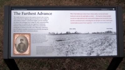
The Farthest Advance
“When I had ridden up to about Crewe’s [slave] cabins, I turned and looked backward, and saw the awful sight as a whole....The long line of dead extended towards our right until lost in the woods and the sloping ravines towards the river, and then extended forward, contracting from our left upon our center, until its apex reached halfway up [to] Crewe’s quarters.” Joseph L. Brent, Confederate staff officer, July 2, 1862
Erected 2011 by Richmond National Battlefield Park.
Topics. This historical marker is listed in this topic list: War, US Civil. A significant historical year for this entry is 1862.
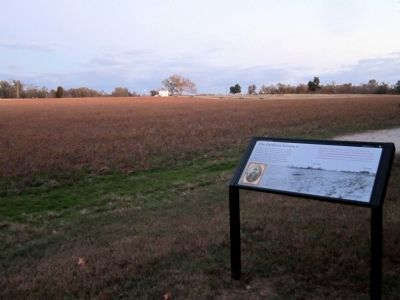
Location. 37° 24.864′ N, 77° 15.121′ W. Marker is in Henrico, Virginia, in Henrico County . Marker can be reached from the intersection of Willis Church Road (Virginia Route 156) and Carters Mill Road, on the right when traveling south. Marker is located in the Malvern Hill Unit of Richmond National Battlefield Park. Touch for map. Marker is at or near this postal address: 9175 Willis Church Road, Henrico VA 23231, United States of America. Touch for directions.
Other nearby markers. At least 8 other markers are within walking distance of this marker. “the grandest sean of all” (about 500 feet away, measured in a direct line); The Malvern Hill Crest (about 600 feet away); Freeman Marker (about 600 feet away); Malvern Hill (about 600 feet away); Union Firepower (about 600 feet away); The Crew House (about 700 feet away); Advantages of Terrain (about 700 feet away); A Place of Refuge (about 700 feet away).
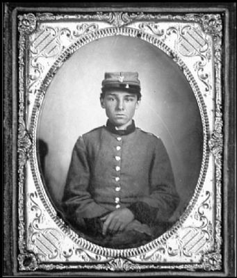
More about this marker. On the left is a photograph with the caption, "Edwin F. Jemison was just 17 years old when he was killed storming the exposed slope of Malvern Hill near this spot. Although a Georgian by birth, Jemison served with the 2nd Louisiana Infantry. Private Jemison’s youthful appearance has made this photograph a classic, used repeatedly to illustrate the far-reaching effects of the Civil War."
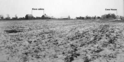
On the right is a photograph with the caption, "The photographer stood 100 yards to your right when he took this view. The former slave cabins still stood in the 1885
photograph. Thousands of attacking Confederates had this very view as they advanced up the slope of Malvern Hill. Records suggest that the inhabitants had evacuated the property prior to the battle." Gilder Lehrman Collection
Also see . . .
1. The Battle of Malvern Hill. Richmond National Battlefield Park (Submitted on November 6, 2011.)
2. Malvern Hill. Civil War Trust (Submitted on November 6, 2011.)
3. Malvern Hill Battlefield Podcast. Richmond National Battlefield Park (Submitted on November 6, 2011.)
Credits. This page was last revised on November 5, 2021. It was originally submitted on November 6, 2011, by Bernard Fisher of Richmond, Virginia. This page has been viewed 581 times since then and 12 times this year. Photos: 1, 2, 3, 4. submitted on November 6, 2011, by Bernard Fisher of Richmond, Virginia.


